Y39 Y39 - Earthquake Result Viewer
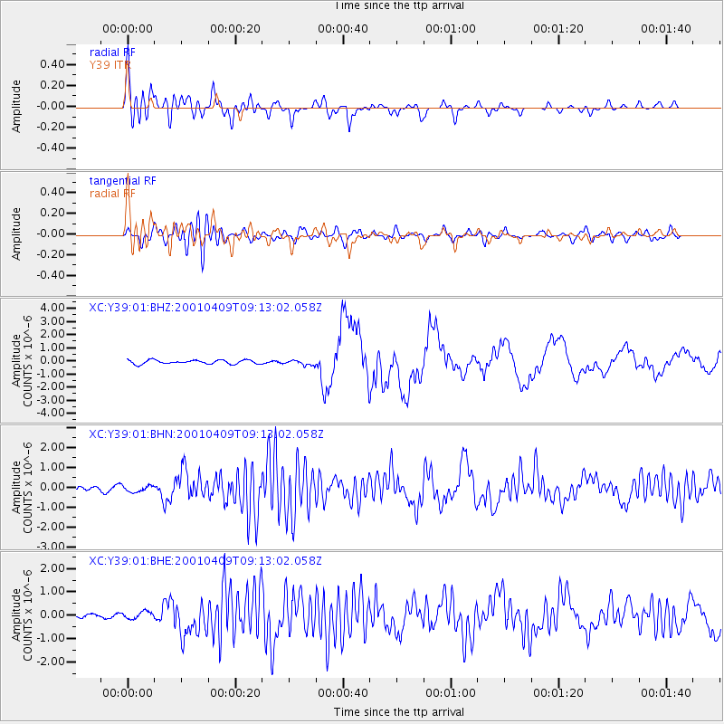
Earthquake location: Off Coast Of Central Chile
Earthquake latitude/longitude: -32.7/-73.1
Earthquake time(UTC): 2001/04/09 (099) 09:00:57 GMT
Earthquake Depth: 11 km
Earthquake Magnitude: 6.1 MB, 6.3 MS, 6.7 MW, 6.3 ME
Earthquake Catalog/Contributor: WHDF/NEIC
Network: XC Yellowstone Intermountain Seismic Array
Station: Y39 Y39
Lat/Lon: 45.59 N/111.22 W
Elevation: 1517 m
Distance: 85.2 deg
Az: 334.222 deg
Baz: 148.505 deg
Ray Param: 0.04492301
Estimated Moho Depth: 38.25 km
Estimated Crust Vp/Vs: 1.74
Assumed Crust Vp: 6.35 km/s
Estimated Crust Vs: 3.655 km/s
Estimated Crust Poisson's Ratio: 0.25
Radial Match: 84.8493 %
Radial Bump: 400
Transverse Match: 70.57016 %
Transverse Bump: 400
SOD ConfigId: 16820
Insert Time: 2010-02-26 14:59:29.473 +0000
GWidth: 2.5
Max Bumps: 400
Tol: 0.001

Signal To Noise

ChannelStoNSTALTA
XC:Y39:01:BHN:20010409T09:13:02.058Z1.37402731.5336184E-71.1161484E-7
XC:Y39:01:BHE:20010409T09:13:02.058Z1.1067121.5163357E-71.3701268E-7
XC:Y39:01:BHZ:20010409T09:13:02.058Z1.28767811.9195403E-71.4906989E-7
Arrivals
Ps4.6 SECOND
PpPs16 SECOND
PsPs/PpSs21 SECOND