
Y39 Y39 - Earthquake Result Viewer
| ||||||||||||||||||
| ||||||||||||||||||
| ||||||||||||||||||
|
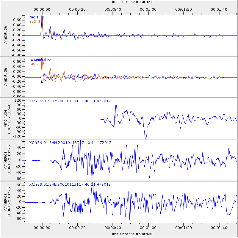
Signal To Noise
| Channel | StoN | STA | LTA |
| XC:Y39:01:BHN:20010113T17:40:11.47201Z | 2.4955518 | 6.4020804E-7 | 2.5653966E-7 |
| XC:Y39:01:BHE:20010113T17:40:11.47201Z | 3.6284068 | 1.083194E-6 | 2.9853157E-7 |
| XC:Y39:01:BHZ:20010113T17:40:11.47201Z | 3.3214896 | 1.4540224E-6 | 4.3776214E-7 |
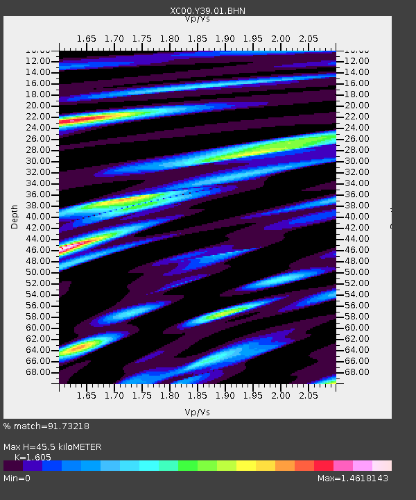
| Arrivals | |
| Ps | 4.7 SECOND |
| PpPs | 17 SECOND |
| PsPs/PpSs | 22 SECOND |

