Y39 Y39 - Earthquake Result Viewer
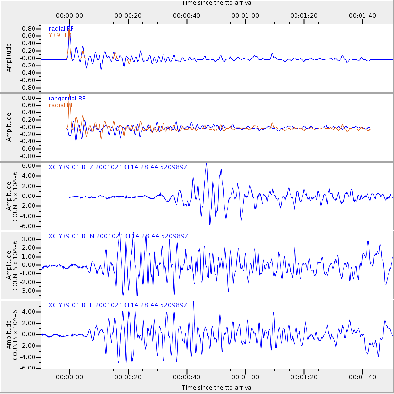
Earthquake location: El Salvador
Earthquake latitude/longitude: 13.7/-88.9
Earthquake time(UTC): 2001/02/13 (044) 14:22:05 GMT
Earthquake Depth: 10 km
Earthquake Magnitude: 5.5 MB, 6.5 MS, 6.6 MW, 6.1 MD
Earthquake Catalog/Contributor: WHDF/NEIC
Network: XC Yellowstone Intermountain Seismic Array
Station: Y39 Y39
Lat/Lon: 45.59 N/111.22 W
Elevation: 1517 m
Distance: 37.0 deg
Az: 333.735 deg
Baz: 142.22 deg
Ray Param: 0.07637977
Estimated Moho Depth: 23.0 km
Estimated Crust Vp/Vs: 1.60
Assumed Crust Vp: 6.35 km/s
Estimated Crust Vs: 3.969 km/s
Estimated Crust Poisson's Ratio: 0.18
Radial Match: 92.25416 %
Radial Bump: 400
Transverse Match: 84.16291 %
Transverse Bump: 400
SOD ConfigId: 3744
Insert Time: 2010-02-26 14:59:34.535 +0000
GWidth: 2.5
Max Bumps: 400
Tol: 0.001

Signal To Noise

ChannelStoNSTALTA
XC:Y39:01:BHN:20010213T14:28:44.520989Z0.592727541.7138798E-72.8915136E-7
XC:Y39:01:BHE:20010213T14:28:44.520989Z0.308441431.0961416E-73.553808E-7
XC:Y39:01:BHZ:20010213T14:28:44.520989Z3.50392345.097737E-71.4548654E-7
Arrivals
Ps2.4 SECOND
PpPs8.7 SECOND
PsPs/PpSs11 SECOND