
Y39 Y39 - Earthquake Result Viewer
| ||||||||||||||||||
| ||||||||||||||||||
| ||||||||||||||||||
|
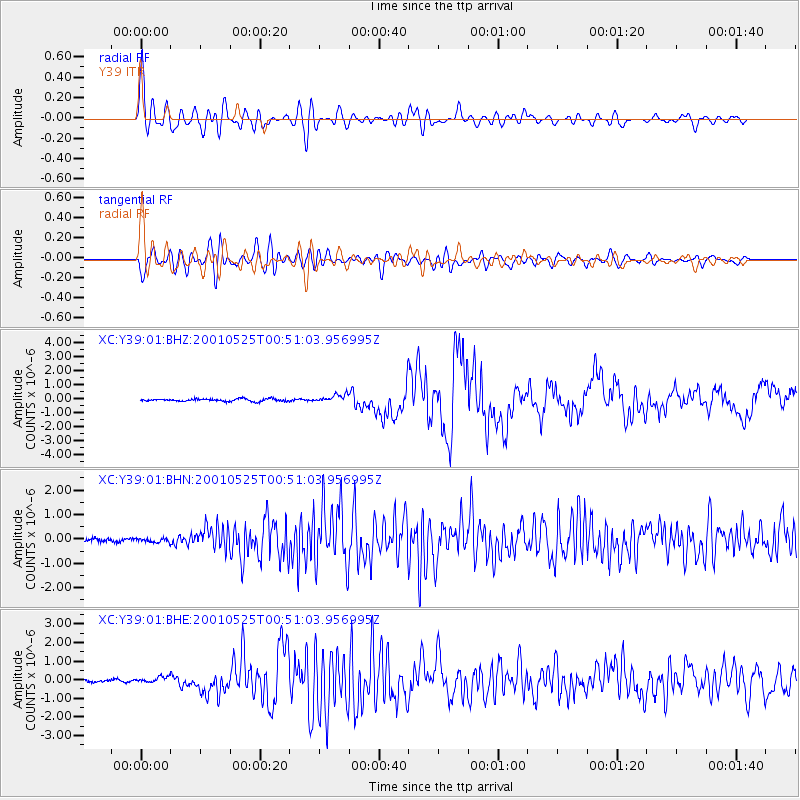
Signal To Noise
| Channel | StoN | STA | LTA |
| XC:Y39:01:BHN:20010525T00:51:03.956995Z | 0.9521962 | 8.806521E-8 | 9.24864E-8 |
| XC:Y39:01:BHE:20010525T00:51:03.956995Z | 1.3816668 | 1.5640116E-7 | 1.13197444E-7 |
| XC:Y39:01:BHZ:20010525T00:51:03.956995Z | 3.0593767 | 2.7604574E-7 | 9.02294E-8 |
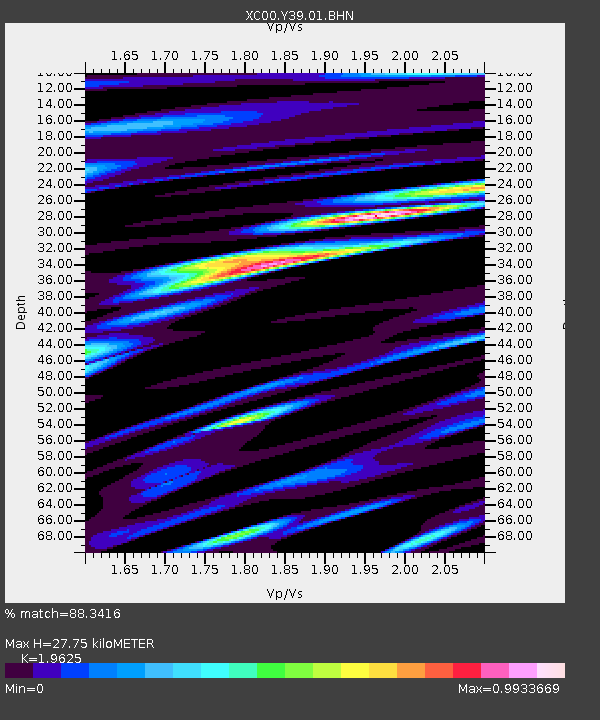
| Arrivals | |
| Ps | 4.4 SECOND |
| PpPs | 12 SECOND |
| PsPs/PpSs | 17 SECOND |

