
Y12 Y12 - Earthquake Result Viewer
| ||||||||||||||||||
| ||||||||||||||||||
| ||||||||||||||||||
|
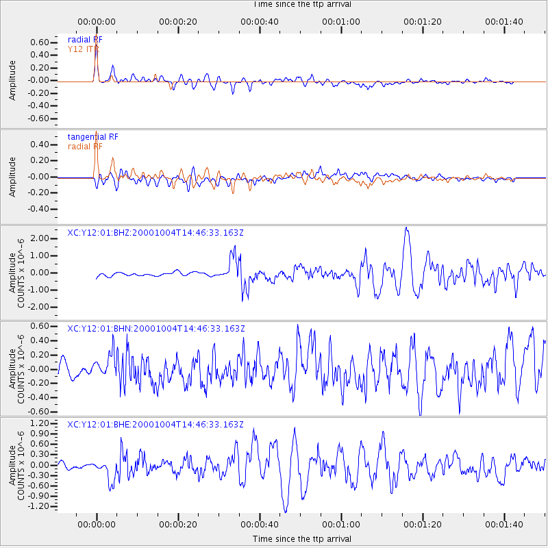
Signal To Noise
| Channel | StoN | STA | LTA |
| XC:Y12:01:BHN:20001004T14:46:33.163Z | 0.9365294 | 1.7945197E-7 | 1.9161382E-7 |
| XC:Y12:01:BHE:20001004T14:46:33.163Z | 3.3756597 | 3.4232482E-7 | 1.01409746E-7 |
| XC:Y12:01:BHZ:20001004T14:46:33.163Z | 6.3831067 | 6.7122676E-7 | 1.05156744E-7 |
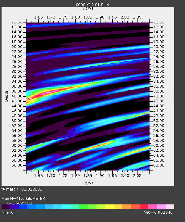
| Arrivals | |
| Ps | 4.0 SECOND |
| PpPs | 15 SECOND |
| PsPs/PpSs | 19 SECOND |

