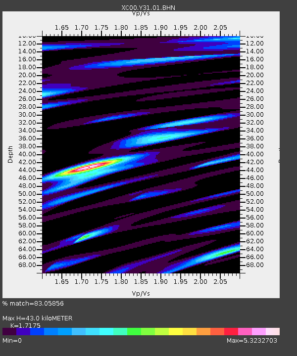
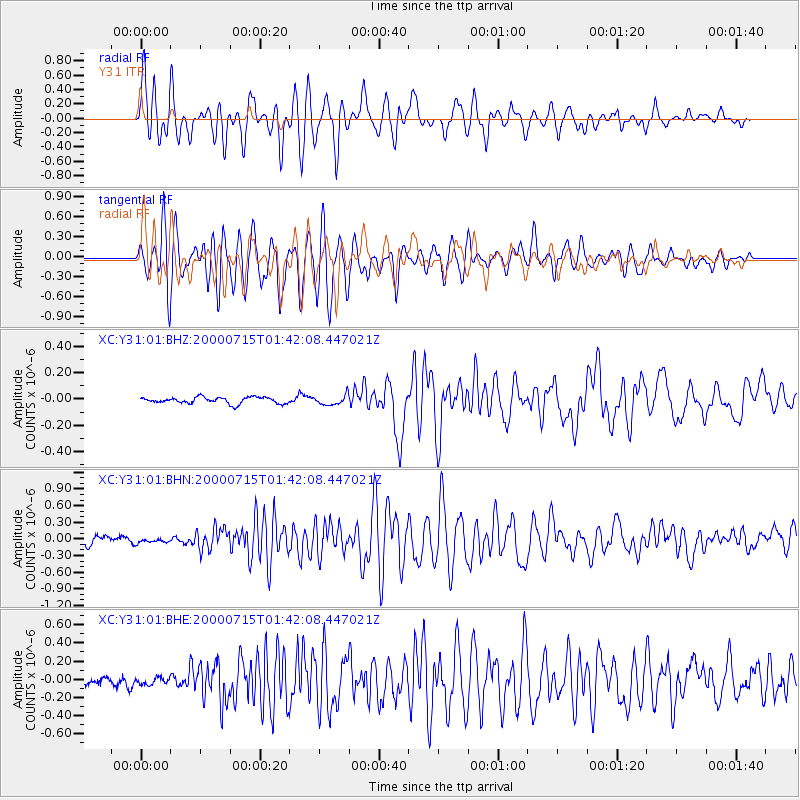
Y31 Y31 - Earthquake Result Viewer

Earthquake location: Near S. Coast Of Honshu, Japan
Earthquake latitude/longitude: 34.3/139.3
Earthquake time(UTC): 2000/07/15 (197) 01:30:30 GMT
Earthquake Depth: 10 km
Earthquake Magnitude: 5.5 MB, 5.9 MS, 6.1 MW, 6.0 MW
Earthquake Catalog/Contributor: WHDF/NEIC
Network: XC Yellowstone Intermountain Seismic Array
Station: Y31 Y31
Lat/Lon: 43.74 N/109.98 W
Elevation: 2789 m
Distance: 80.0 deg
Az: 43.489 deg
Baz: 308.191 deg
Ray Param: 0.048594184
Estimated Moho Depth: 43.0 km
Estimated Crust Vp/Vs: 1.72
Assumed Crust Vp: 6.161 km/s
Estimated Crust Vs: 3.587 km/s
Estimated Crust Poisson's Ratio: 0.24
Radial Match: 83.05856 %
Radial Bump: 400
Transverse Match: 80.83273 %
Transverse Bump: 400
SOD ConfigId: 3744
Insert Time: 2010-02-26 15:00:22.628 +0000
GWidth: 2.5
Max Bumps: 400
Tol: 0.001

Signal To Noise

ChannelStoNSTALTA
XC:Y31:01:BHN:20000715T01:42:08.447021Z0.366117453.089732E-88.439182E-8
XC:Y31:01:BHE:20000715T01:42:08.447021Z0.374002963.7993E-81.0158476E-7
XC:Y31:01:BHZ:20000715T01:42:08.447021Z1.541753.6821135E-82.388269E-8
Arrivals
Ps5.1 SECOND
PpPs18 SECOND
PsPs/PpSs24 SECOND