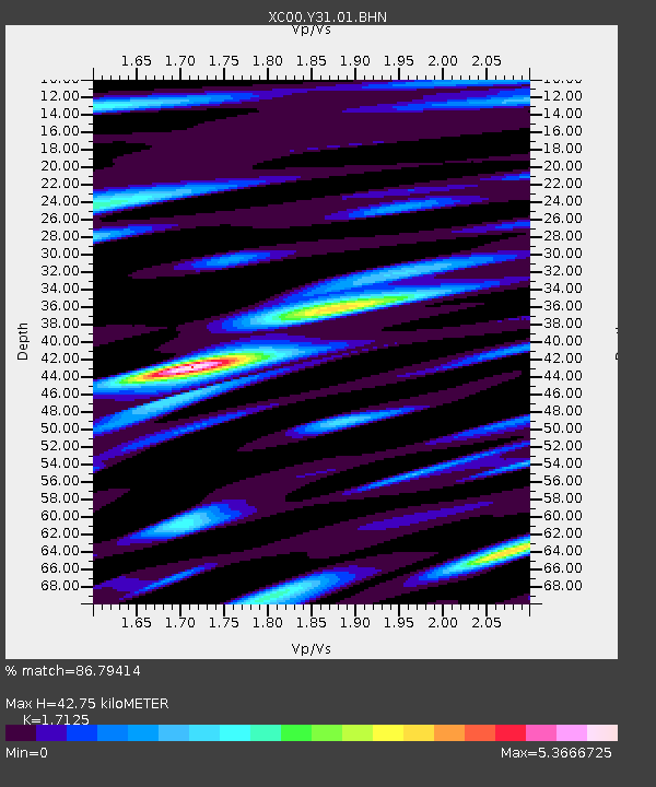
Y31 Y31 - Earthquake Result Viewer
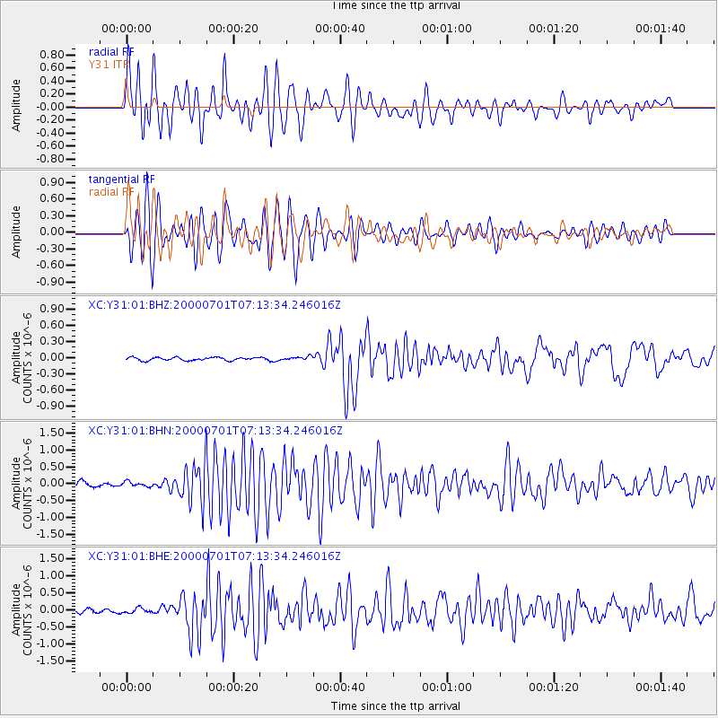
Earthquake location: Near S. Coast Of Honshu, Japan
Earthquake latitude/longitude: 34.2/139.1
Earthquake time(UTC): 2000/07/01 (183) 07:01:55 GMT
Earthquake Depth: 10 km
Earthquake Magnitude: 6.0 MB, 6.1 MS, 6.2 MW, 6.2 MW
Earthquake Catalog/Contributor: WHDF/NEIC
Network: XC Yellowstone Intermountain Seismic Array
Station: Y31 Y31
Lat/Lon: 43.74 N/109.98 W
Elevation: 2789 m
Distance: 80.1 deg
Az: 43.419 deg
Baz: 308.201 deg
Ray Param: 0.048495404
Estimated Moho Depth: 42.75 km
Estimated Crust Vp/Vs: 1.71
Assumed Crust Vp: 6.161 km/s
Estimated Crust Vs: 3.598 km/s
Estimated Crust Poisson's Ratio: 0.24
Radial Match: 86.79414 %
Radial Bump: 400
Transverse Match: 86.588 %
Transverse Bump: 400
SOD ConfigId: 3744
Insert Time: 2010-02-26 15:00:23.592 +0000
GWidth: 2.5
Max Bumps: 400
Tol: 0.001

Signal To Noise

ChannelStoNSTALTA
XC:Y31:01:BHN:20000701T07:13:34.246016Z0.97879396.949051E-87.0996066E-8
XC:Y31:01:BHE:20000701T07:13:34.246016Z1.2306777.260306E-85.8994406E-8
XC:Y31:01:BHZ:20000701T07:13:34.246016Z1.13120663.2621802E-82.8838059E-8
Arrivals
Ps5.1 SECOND
PpPs18 SECOND
PsPs/PpSs23 SECOND