
Y31 Y31 - Earthquake Result Viewer
| ||||||||||||||||||
| ||||||||||||||||||
| ||||||||||||||||||
|
Signal To Noise
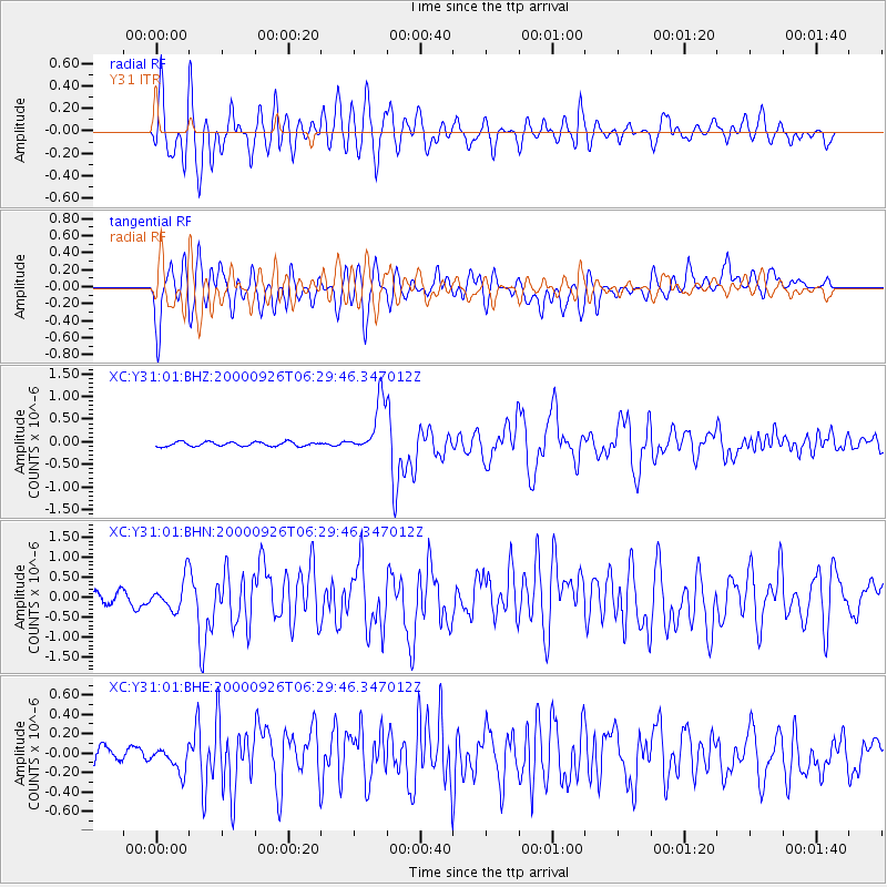
| Channel | StoN | STA | LTA |
| XC:Y31:01:BHN:20000926T06:29:46.347012Z | 1.5280621 | 4.028981E-7 | 2.6366607E-7 |
| XC:Y31:01:BHE:20000926T06:29:46.347012Z | 1.9089136 | 1.5572448E-7 | 8.157755E-8 |
| XC:Y31:01:BHZ:20000926T06:29:46.347012Z | 12.391274 | 5.8596135E-7 | 4.7288225E-8 |
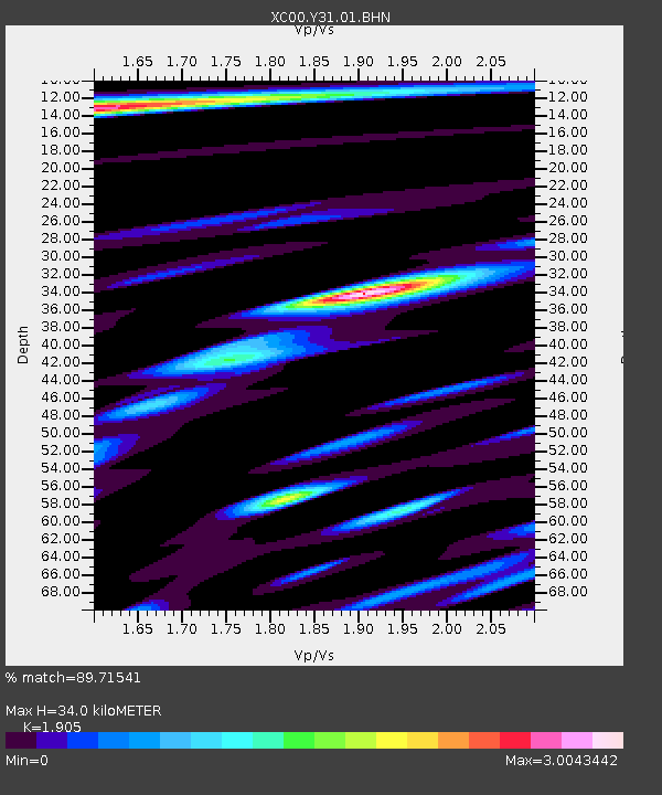
| Arrivals | |
| Ps | 5.1 SECOND |
| PpPs | 16 SECOND |
| PsPs/PpSs | 21 SECOND |

