
Y102 Y102 - Earthquake Result Viewer
| ||||||||||||||||||
| ||||||||||||||||||
| ||||||||||||||||||
|
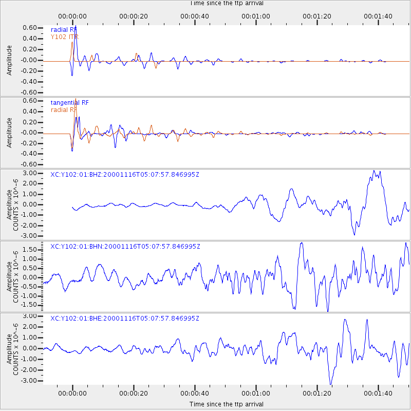
Signal To Noise
| Channel | StoN | STA | LTA |
| XC:Y102:01:BHN:20001116T05:07:57.846995Z | 1.1073303 | 2.7657384E-7 | 2.4976634E-7 |
| XC:Y102:01:BHE:20001116T05:07:57.846995Z | 1.2271217 | 2.4090448E-7 | 1.963167E-7 |
| XC:Y102:01:BHZ:20001116T05:07:57.846995Z | 1.0838091 | 1.6262365E-7 | 1.5004824E-7 |
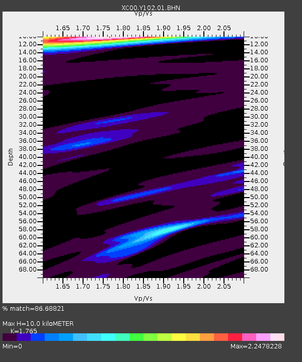
| Arrivals | |
| Ps | 1.2 SECOND |
| PpPs | 4.3 SECOND |
| PsPs/PpSs | 5.5 SECOND |

