You are here: Home > Network List > XC00 - Yellowstone Intermountain Seismic Array Stations List
> Station Y102 Y102 > Earthquake Result Viewer
Y102 Y102 - Earthquake Result Viewer

| Earthquake location: |
Bonin Islands, Japan Region |
| Earthquake latitude/longitude: |
26.3/140.5 |
| Earthquake time(UTC): |
2000/10/27 (301) 04:21:51 GMT |
| Earthquake Depth: |
388 km |
| Earthquake Magnitude: |
6.1 MB, 6.1 MW, 6.0 MW |
| Earthquake Catalog/Contributor: |
WHDF/NEIC |
|
| Network: |
XC Yellowstone Intermountain Seismic Array |
| Station: |
Y102 Y102 |
| Lat/Lon: |
44.32 N/110.60 W |
| Elevation: |
2438 m |
|
| Distance: |
84.4 deg |
| Az: |
43.018 deg |
| Baz: |
301.419 deg |
| Ray Param: |
0.04446389 |
| Estimated Moho Depth: |
11.0 km |
| Estimated Crust Vp/Vs: |
1.67 |
| Assumed Crust Vp: |
6.35 km/s |
| Estimated Crust Vs: |
3.808 km/s |
| Estimated Crust Poisson's Ratio: |
0.22 |
|
| Radial Match: |
81.673615 % |
| Radial Bump: |
400 |
| Transverse Match: |
71.35207 % |
| Transverse Bump: |
400 |
| SOD ConfigId: |
3744 |
| Insert Time: |
2010-02-26 15:00:29.298 +0000 |
| GWidth: |
2.5 |
| Max Bumps: |
400 |
| Tol: |
0.001 |
|
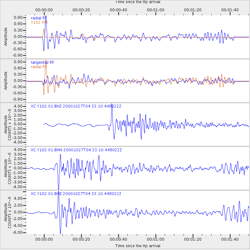
Signal To Noise
| Channel | StoN | STA | LTA |
| XC:Y102:01:BHN:20001027T04:33:10.448022Z | 0.4850811 | 1.16922614E-7 | 2.4103724E-7 |
| XC:Y102:01:BHE:20001027T04:33:10.448022Z | 0.76440936 | 1.7189933E-7 | 2.2487863E-7 |
| XC:Y102:01:BHZ:20001027T04:33:10.448022Z | 0.9488878 | 1.7976247E-7 | 1.8944543E-7 |
| Arrivals |
| Ps | 1.2 SECOND |
| PpPs | 4.5 SECOND |
| PsPs/PpSs | 5.7 SECOND |


