Y102 Y102 - Earthquake Result Viewer
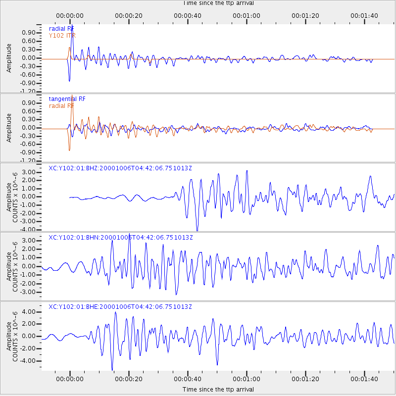
Earthquake location: Western Honshu, Japan
Earthquake latitude/longitude: 35.5/133.1
Earthquake time(UTC): 2000/10/06 (280) 04:30:19 GMT
Earthquake Depth: 10 km
Earthquake Magnitude: 5.8 MB, 6.8 MS, 7.0 ME, 6.7 MW
Earthquake Catalog/Contributor: WHDF/NEIC
Network: XC Yellowstone Intermountain Seismic Array
Station: Y102 Y102
Lat/Lon: 44.32 N/110.60 W
Elevation: 2438 m
Distance: 81.8 deg
Az: 40.572 deg
Baz: 312.294 deg
Ray Param: 0.047336735
Estimated Moho Depth: 11.0 km
Estimated Crust Vp/Vs: 1.60
Assumed Crust Vp: 6.35 km/s
Estimated Crust Vs: 3.969 km/s
Estimated Crust Poisson's Ratio: 0.18
Radial Match: 88.14355 %
Radial Bump: 400
Transverse Match: 75.02163 %
Transverse Bump: 400
SOD ConfigId: 3744
Insert Time: 2010-02-26 15:00:30.280 +0000
GWidth: 2.5
Max Bumps: 400
Tol: 0.001

Signal To Noise

ChannelStoNSTALTA
XC:Y102:01:BHN:20001006T04:42:06.751013Z1.38244624.423139E-73.199502E-7
XC:Y102:01:BHE:20001006T04:42:06.751013Z0.82689293.2138382E-73.8866435E-7
XC:Y102:01:BHZ:20001006T04:42:06.751013Z0.642959061.13014465E-71.7577241E-7
Arrivals
Ps1.1 SECOND
PpPs4.4 SECOND
PsPs/PpSs5.4 SECOND