
Y102 Y102 - Earthquake Result Viewer
| ||||||||||||||||||
| ||||||||||||||||||
| ||||||||||||||||||
|
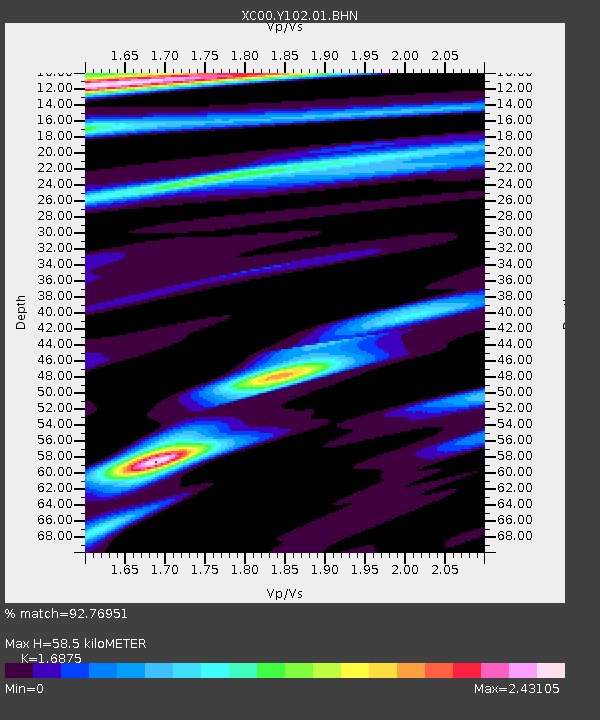
Signal To Noise
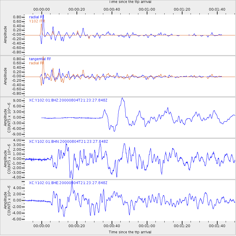
| Channel | StoN | STA | LTA |
| XC:Y102:01:BHN:20000804T21:23:27.848Z | 1.0927607 | 1.30222E-7 | 1.1916791E-7 |
| XC:Y102:01:BHE:20000804T21:23:27.848Z | 1.0252222 | 1.897792E-7 | 1.8511031E-7 |
| XC:Y102:01:BHZ:20000804T21:23:27.848Z | 1.1470679 | 1.420216E-7 | 1.2381273E-7 |
| Arrivals | |
| Ps | 6.6 SECOND |
| PpPs | 24 SECOND |
| PsPs/PpSs | 30 SECOND |

