
Y102 Y102 - Earthquake Result Viewer
| ||||||||||||||||||
| ||||||||||||||||||
| ||||||||||||||||||
|
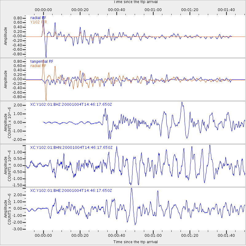
Signal To Noise
| Channel | StoN | STA | LTA |
| XC:Y102:01:BHN:20001004T14:46:17.650Z | 0.97655994 | 1.7328925E-7 | 1.7744865E-7 |
| XC:Y102:01:BHE:20001004T14:46:17.650Z | 3.684272 | 4.7918047E-7 | 1.300611E-7 |
| XC:Y102:01:BHZ:20001004T14:46:17.650Z | 7.411035 | 5.9698175E-7 | 8.0553086E-8 |
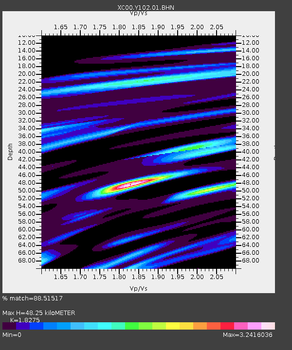
| Arrivals | |
| Ps | 6.6 SECOND |
| PpPs | 20 SECOND |
| PsPs/PpSs | 27 SECOND |

