Y22 Y22 - Earthquake Result Viewer
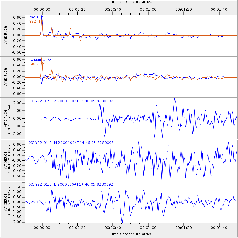
Earthquake location: Windward Islands
Earthquake latitude/longitude: 11.1/-62.6
Earthquake time(UTC): 2000/10/04 (278) 14:37:44 GMT
Earthquake Depth: 110 km
Earthquake Magnitude: 5.6 MB, 5.4 MS, 6.1 MW, 5.9 MD
Earthquake Catalog/Contributor: WHDF/NEIC
Network: XC Yellowstone Intermountain Seismic Array
Station: Y22 Y22
Lat/Lon: 42.59 N/109.25 W
Elevation: 2574 m
Distance: 51.2 deg
Az: 316.419 deg
Baz: 113.623 deg
Ray Param: 0.06719732
Estimated Moho Depth: 46.5 km
Estimated Crust Vp/Vs: 1.72
Assumed Crust Vp: 6.161 km/s
Estimated Crust Vs: 3.587 km/s
Estimated Crust Poisson's Ratio: 0.24
Radial Match: 83.03274 %
Radial Bump: 400
Transverse Match: 72.28881 %
Transverse Bump: 400
SOD ConfigId: 16820
Insert Time: 2010-02-26 15:01:05.752 +0000
GWidth: 2.5
Max Bumps: 400
Tol: 0.001

Signal To Noise

ChannelStoNSTALTA
XC:Y22:01:BHN:20001004T14:46:05.828009Z1.6337212.9986887E-71.8354963E-7
XC:Y22:01:BHE:20001004T14:46:05.828009Z1.95737675.1154456E-72.6134188E-7
XC:Y22:01:BHZ:20001004T14:46:05.828009Z6.15260658.118398E-71.3195054E-7
Arrivals
Ps5.7 SECOND
PpPs19 SECOND
PsPs/PpSs25 SECOND