
Y04 Y04 - Earthquake Result Viewer
| ||||||||||||||||||
| ||||||||||||||||||
| ||||||||||||||||||
|
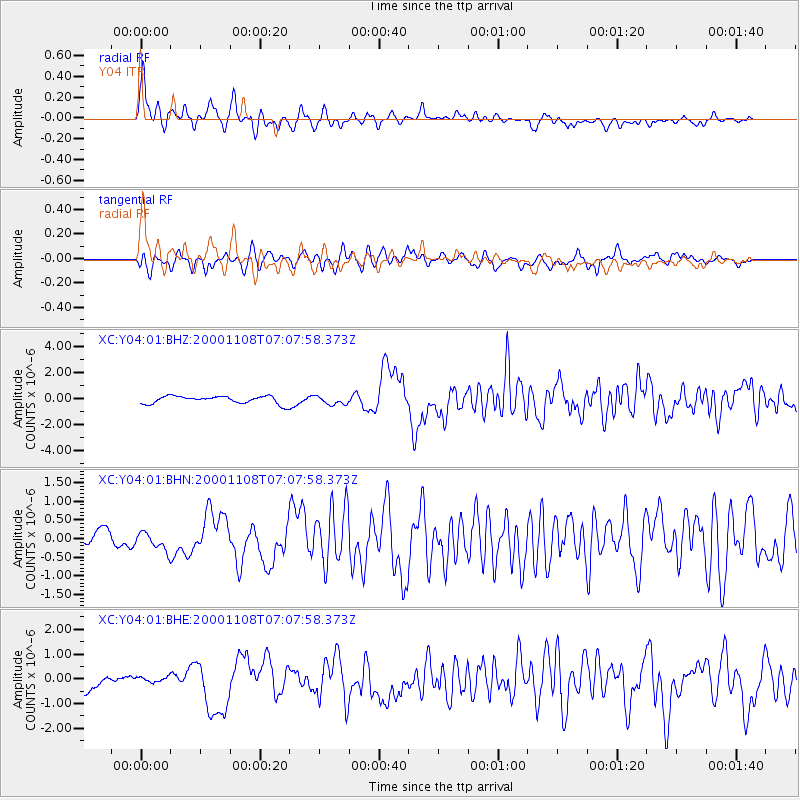
Signal To Noise
| Channel | StoN | STA | LTA |
| XC:Y04:01:BHN:20001108T07:07:58.373Z | 1.1761606 | 2.3956562E-7 | 2.0368445E-7 |
| XC:Y04:01:BHE:20001108T07:07:58.373Z | 0.542988 | 1.4615104E-7 | 2.6916072E-7 |
| XC:Y04:01:BHZ:20001108T07:07:58.373Z | 1.1286848 | 3.2439465E-7 | 2.8740942E-7 |
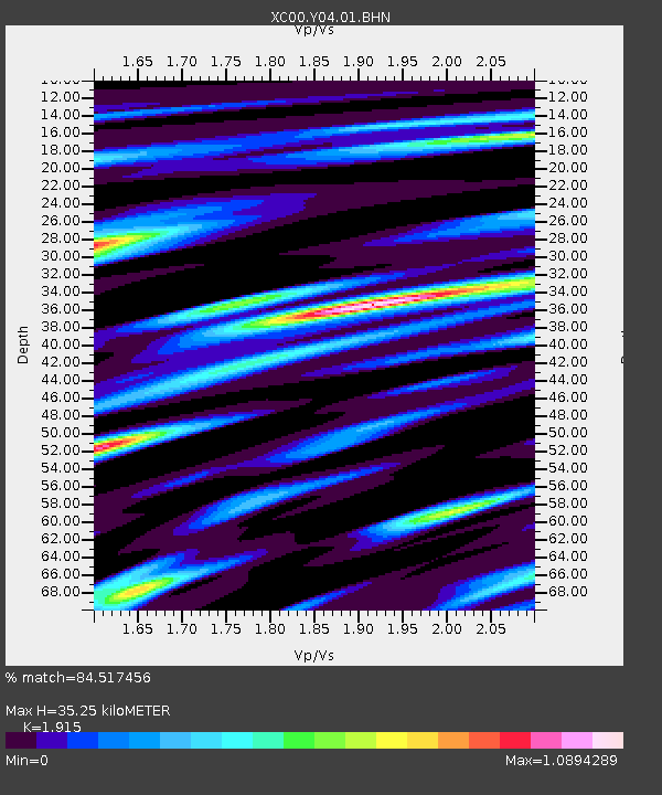
| Arrivals | |
| Ps | 5.5 SECOND |
| PpPs | 16 SECOND |
| PsPs/PpSs | 21 SECOND |

