Y04 Y04 - Earthquake Result Viewer
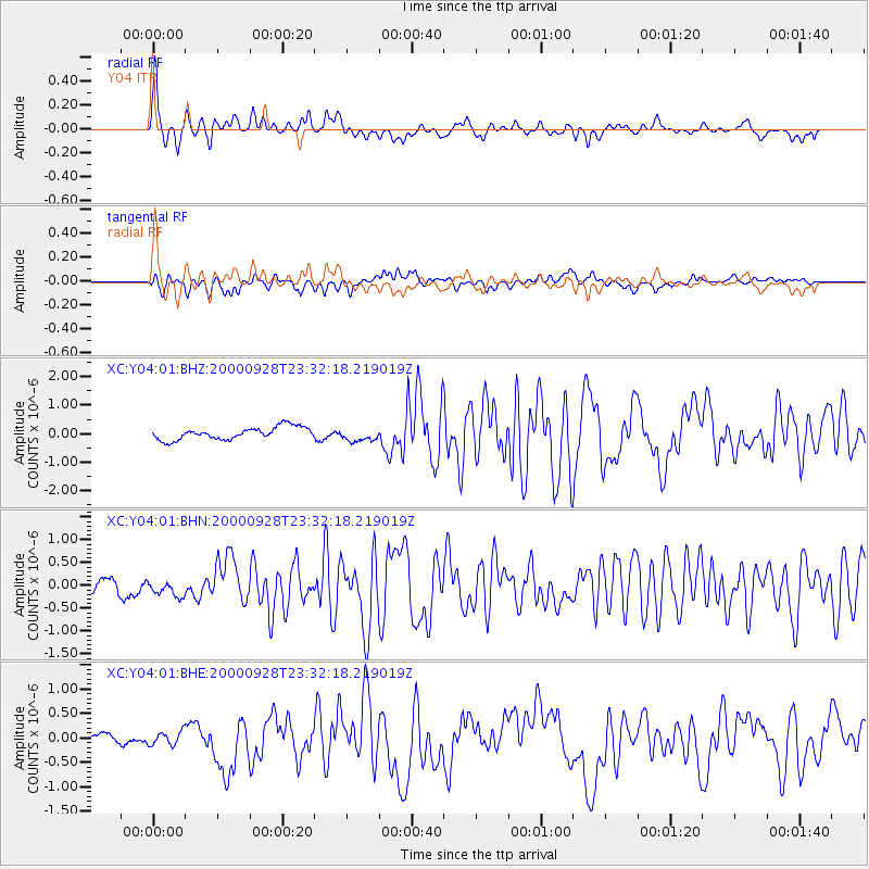
Earthquake location: Near Coast Of Ecuador
Earthquake latitude/longitude: -0.2/-80.6
Earthquake time(UTC): 2000/09/28 (272) 23:23:43 GMT
Earthquake Depth: 23 km
Earthquake Magnitude: 5.8 MB, 6.0 MS, 6.6 MW, 6.4 MW
Earthquake Catalog/Contributor: WHDF/NEIC
Network: XC Yellowstone Intermountain Seismic Array
Station: Y04 Y04
Lat/Lon: 43.51 N/111.90 W
Elevation: 1502 m
Distance: 51.8 deg
Az: 331.218 deg
Baz: 138.563 deg
Ray Param: 0.06716862
Estimated Moho Depth: 63.25 km
Estimated Crust Vp/Vs: 1.94
Assumed Crust Vp: 6.207 km/s
Estimated Crust Vs: 3.195 km/s
Estimated Crust Poisson's Ratio: 0.32
Radial Match: 83.214264 %
Radial Bump: 400
Transverse Match: 73.662025 %
Transverse Bump: 400
SOD ConfigId: 3744
Insert Time: 2010-02-26 15:01:13.968 +0000
GWidth: 2.5
Max Bumps: 400
Tol: 0.001

Signal To Noise

ChannelStoNSTALTA
XC:Y04:01:BHN:20000928T23:32:18.219019Z1.26685231.8148747E-71.4325859E-7
XC:Y04:01:BHE:20000928T23:32:18.219019Z0.570063771.3857277E-72.4308292E-7
XC:Y04:01:BHZ:20000928T23:32:18.219019Z1.08113132.362511E-72.1852212E-7
Arrivals
Ps10 SECOND
PpPs29 SECOND
PsPs/PpSs39 SECOND