Y04 Y04 - Earthquake Result Viewer
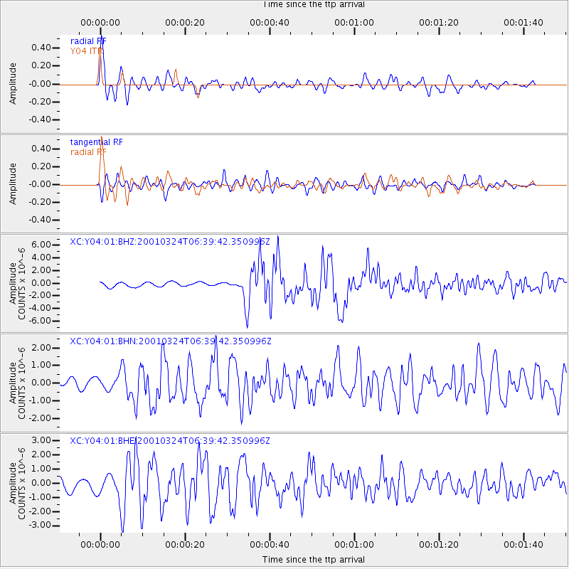
Earthquake location: Western Honshu, Japan
Earthquake latitude/longitude: 34.1/132.5
Earthquake time(UTC): 2001/03/24 (083) 06:27:53 GMT
Earthquake Depth: 50 km
Earthquake Magnitude: 6.4 MB, 6.5 MS, 6.8 MW, 6.4 ME
Earthquake Catalog/Contributor: WHDF/NEIC
Network: XC Yellowstone Intermountain Seismic Array
Station: Y04 Y04
Lat/Lon: 43.51 N/111.90 W
Elevation: 1502 m
Distance: 83.0 deg
Az: 41.391 deg
Baz: 311.036 deg
Ray Param: 0.046418305
Estimated Moho Depth: 12.75 km
Estimated Crust Vp/Vs: 1.60
Assumed Crust Vp: 6.207 km/s
Estimated Crust Vs: 3.879 km/s
Estimated Crust Poisson's Ratio: 0.18
Radial Match: 86.51959 %
Radial Bump: 400
Transverse Match: 74.99781 %
Transverse Bump: 400
SOD ConfigId: 4714
Insert Time: 2010-02-26 15:01:19.696 +0000
GWidth: 2.5
Max Bumps: 400
Tol: 0.001

Signal To Noise

ChannelStoNSTALTA
XC:Y04:01:BHN:20010324T06:39:42.350996Z2.03882153.9988836E-71.9613704E-7
XC:Y04:01:BHE:20010324T06:39:42.350996Z1.22988088.2637087E-76.719113E-7
XC:Y04:01:BHZ:20010324T06:39:42.350996Z5.70211032.0589089E-63.610784E-7
Arrivals
Ps1.3 SECOND
PpPs5.2 SECOND
PsPs/PpSs6.5 SECOND