Y04 Y04 - Earthquake Result Viewer
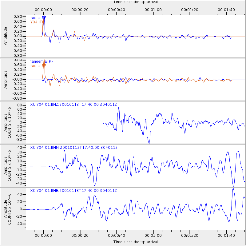
Earthquake location: El Salvador
Earthquake latitude/longitude: 13.0/-88.7
Earthquake time(UTC): 2001/01/13 (013) 17:33:32 GMT
Earthquake Depth: 60 km
Earthquake Magnitude: 6.4 MB, 7.8 MS, 7.7 MW, 7.5 ME
Earthquake Catalog/Contributor: WHDF/NEIC
Network: XC Yellowstone Intermountain Seismic Array
Station: Y04 Y04
Lat/Lon: 43.51 N/111.90 W
Elevation: 1502 m
Distance: 36.4 deg
Az: 331.034 deg
Baz: 139.556 deg
Ray Param: 0.07656197
Estimated Moho Depth: 36.0 km
Estimated Crust Vp/Vs: 1.94
Assumed Crust Vp: 6.207 km/s
Estimated Crust Vs: 3.203 km/s
Estimated Crust Poisson's Ratio: 0.32
Radial Match: 93.74279 %
Radial Bump: 390
Transverse Match: 76.48011 %
Transverse Bump: 400
SOD ConfigId: 16820
Insert Time: 2010-02-26 15:01:20.743 +0000
GWidth: 2.5
Max Bumps: 400
Tol: 0.001

Signal To Noise

ChannelStoNSTALTA
XC:Y04:01:BHN:20010113T17:40:00.304011Z2.66571457.845736E-72.943202E-7
XC:Y04:01:BHE:20010113T17:40:00.304011Z2.15560448.562904E-73.9723915E-7
XC:Y04:01:BHZ:20010113T17:40:00.304011Z11.0920442.8045717E-62.5284535E-7
Arrivals
Ps5.8 SECOND
PpPs16 SECOND
PsPs/PpSs22 SECOND