You are here: Home > Network List > IC - New China Digital Seismograph Network Stations List
> Station HIA Hailar, Neimenggu Autonomous Region, China > Earthquake Result Viewer
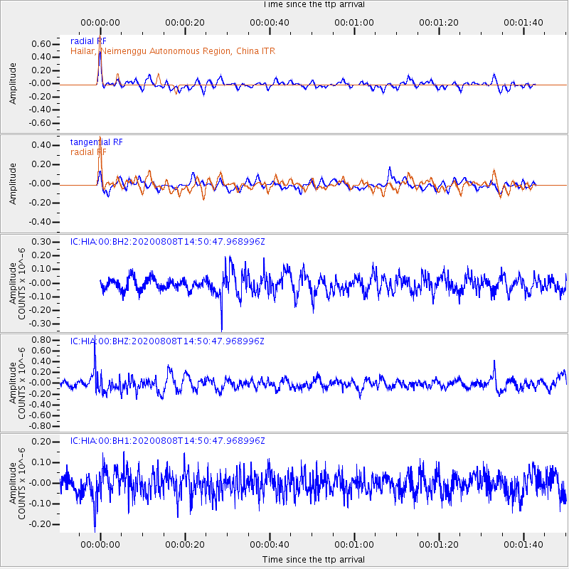
HIA Hailar, Neimenggu Autonomous Region, China - Earthquake Result Viewer
*The percent match for this event was below the threshold and hence no stack was calculated.
| Earthquake location: |
Alaska Peninsula |
| Earthquake latitude/longitude: |
54.8/-161.3 |
| Earthquake time(UTC): |
2020/08/08 (221) 14:42:55 GMT |
| Earthquake Depth: |
42 km |
| Earthquake Magnitude: |
5.5 mww |
| Earthquake Catalog/Contributor: |
NEIC PDE/us |
|
| Network: |
IC New China Digital Seismograph Network |
| Station: |
HIA Hailar, Neimenggu Autonomous Region, China |
| Lat/Lon: |
49.27 N/119.74 E |
| Elevation: |
620 m |
|
| Distance: |
46.5 deg |
| Az: |
297.563 deg |
| Baz: |
51.598 deg |
| Ray Param: |
$rayparam |
*The percent match for this event was below the threshold and hence was not used in the summary stack. |
|
| Radial Match: |
74.73662 % |
| Radial Bump: |
400 |
| Transverse Match: |
58.38193 % |
| Transverse Bump: |
400 |
| SOD ConfigId: |
21709731 |
| Insert Time: |
2020-08-22 14:51:59.929 +0000 |
| GWidth: |
2.5 |
| Max Bumps: |
400 |
| Tol: |
0.001 |
|
Signal To Noise
| Channel | StoN | STA | LTA |
| IC:HIA:00:BHZ:20200808T14:50:47.968996Z | 2.628032 | 1.2790521E-7 | 4.866958E-8 |
| IC:HIA:00:BH1:20200808T14:50:47.968996Z | 1.4457113 | 6.224644E-8 | 4.305593E-8 |
| IC:HIA:00:BH2:20200808T14:50:47.968996Z | 2.5430846 | 1.012293E-7 | 3.9805713E-8 |
| Arrivals |
| Ps | |
| PpPs | |
| PsPs/PpSs | |


