Y40 Y40 - Earthquake Result Viewer
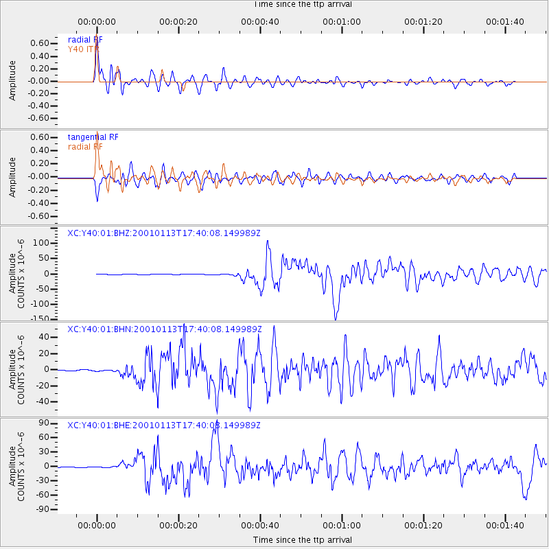
Earthquake location: El Salvador
Earthquake latitude/longitude: 13.0/-88.7
Earthquake time(UTC): 2001/01/13 (013) 17:33:32 GMT
Earthquake Depth: 60 km
Earthquake Magnitude: 6.4 MB, 7.8 MS, 7.7 MW, 7.5 ME
Earthquake Catalog/Contributor: WHDF/NEIC
Network: XC Yellowstone Intermountain Seismic Array
Station: Y40 Y40
Lat/Lon: 45.35 N/110.75 W
Elevation: 1547 m
Distance: 37.3 deg
Az: 334.029 deg
Baz: 142.754 deg
Ray Param: 0.07606311
Estimated Moho Depth: 13.5 km
Estimated Crust Vp/Vs: 1.60
Assumed Crust Vp: 6.35 km/s
Estimated Crust Vs: 3.963 km/s
Estimated Crust Poisson's Ratio: 0.18
Radial Match: 93.823616 %
Radial Bump: 400
Transverse Match: 88.3205 %
Transverse Bump: 400
SOD ConfigId: 16820
Insert Time: 2010-02-26 15:01:36.113 +0000
GWidth: 2.5
Max Bumps: 400
Tol: 0.001

Signal To Noise

ChannelStoNSTALTA
XC:Y40:01:BHN:20010113T17:40:08.149989Z1.42955737.0191635E-74.910026E-7
XC:Y40:01:BHE:20010113T17:40:08.149989Z1.94748991.0595821E-65.4407576E-7
XC:Y40:01:BHZ:20010113T17:40:08.149989Z2.42336732.1063818E-68.6919624E-7
Arrivals
Ps1.4 SECOND
PpPs5.1 SECOND
PsPs/PpSs6.5 SECOND