You are here: Home > Network List > XC00 - Yellowstone Intermountain Seismic Array Stations List
> Station Y03 Y03 > Earthquake Result Viewer
Y03 Y03 - Earthquake Result Viewer
| Earthquake location: |
Sea Of Okhotsk |
| Earthquake latitude/longitude: |
46.8/145.4 |
| Earthquake time(UTC): |
2000/07/10 (192) 09:58:18 GMT |
| Earthquake Depth: |
360 km |
| Earthquake Magnitude: |
6.1 MB, 5.9 MW, 5.8 MW |
| Earthquake Catalog/Contributor: |
WHDF/NEIC |
|
| Network: |
XC Yellowstone Intermountain Seismic Array |
| Station: |
Y03 Y03 |
| Lat/Lon: |
43.81 N/112.31 W |
| Elevation: |
1478 m |
|
| Distance: |
66.7 deg |
| Az: |
50.394 deg |
| Baz: |
313.058 deg |
| Ray Param: |
0.056306235 |
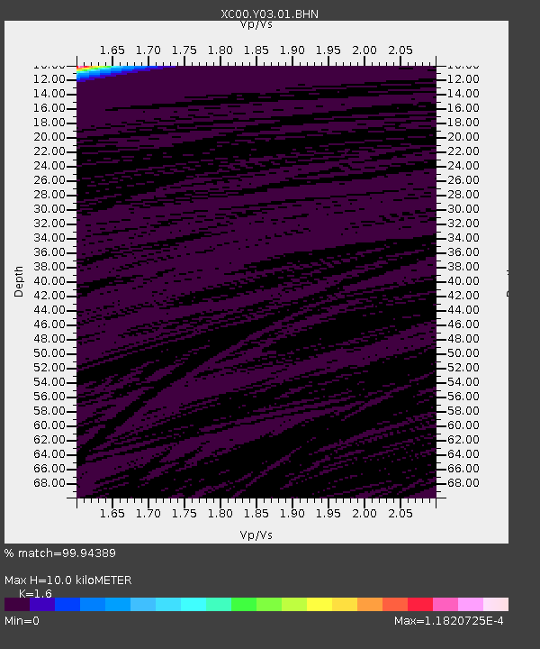
| Estimated Moho Depth: |
10.0 km |
| Estimated Crust Vp/Vs: |
1.60 |
| Assumed Crust Vp: |
6.279 km/s |
| Estimated Crust Vs: |
3.924 km/s |
| Estimated Crust Poisson's Ratio: |
0.18 |
|
| Radial Match: |
99.94389 % |
| Radial Bump: |
4 |
| Transverse Match: |
99.99869 % |
| Transverse Bump: |
2 |
| SOD ConfigId: |
16820 |
| Insert Time: |
2010-02-26 15:01:43.262 +0000 |
| GWidth: |
2.5 |
| Max Bumps: |
400 |
| Tol: |
0.001 |
|
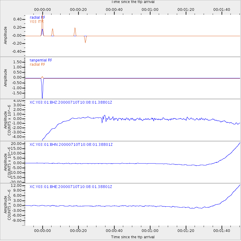
Signal To Noise
| Channel | StoN | STA | LTA |
| XC:Y03:01:BHN:20000710T10:08:01.38801Z | 0.9125349 | 1.5938916E-6 | 1.7466638E-6 |
| XC:Y03:01:BHE:20000710T10:08:01.38801Z | 0.9144023 | 9.689641E-7 | 1.0596693E-6 |
| XC:Y03:01:BHZ:20000710T10:08:01.38801Z | 0.9504106 | 1.3885588E-6 | 1.4610093E-6 |
| Arrivals |
| Ps | 1.0 SECOND |
| PpPs | 4.0 SECOND |
| PsPs/PpSs | 5.0 SECOND |


