
Y03 Y03 - Earthquake Result Viewer
| ||||||||||||||||||
| ||||||||||||||||||
| ||||||||||||||||||
|
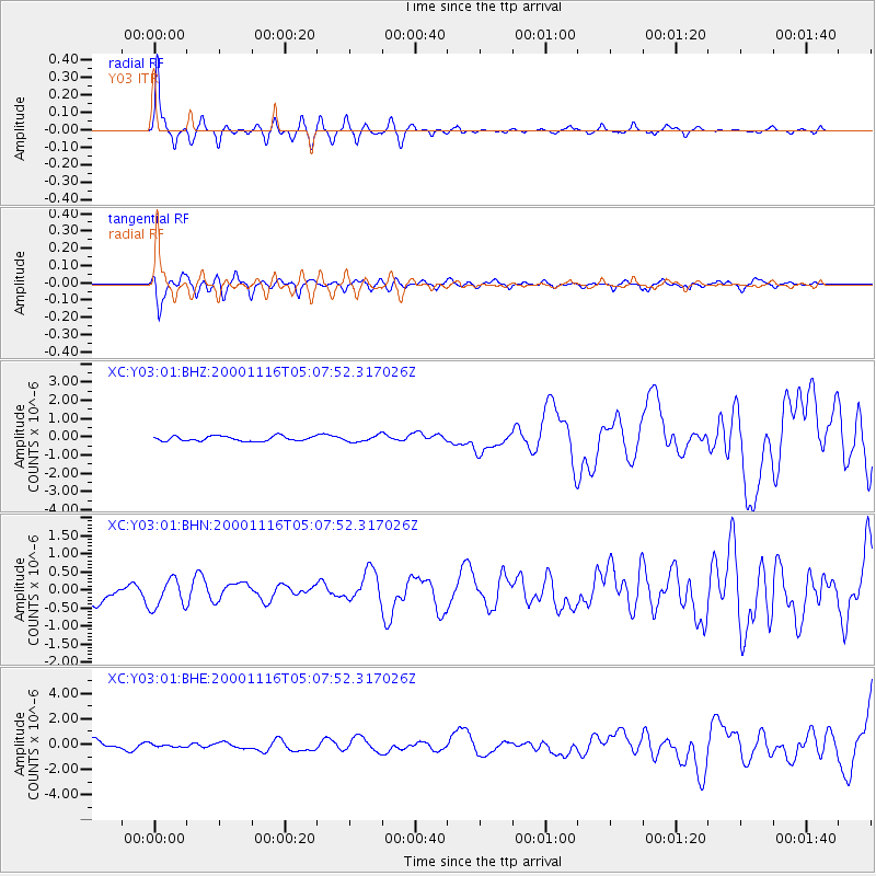
Signal To Noise
| Channel | StoN | STA | LTA |
| XC:Y03:01:BHN:20001116T05:07:52.317026Z | 1.2859025 | 4.120419E-7 | 3.2043013E-7 |
| XC:Y03:01:BHE:20001116T05:07:52.317026Z | 0.41586813 | 1.3450355E-7 | 3.2342837E-7 |
| XC:Y03:01:BHZ:20001116T05:07:52.317026Z | 1.3009657 | 1.7236009E-7 | 1.3248628E-7 |
| Arrivals | |
| Ps | 1.2 SECOND |
| PpPs | 4.8 SECOND |
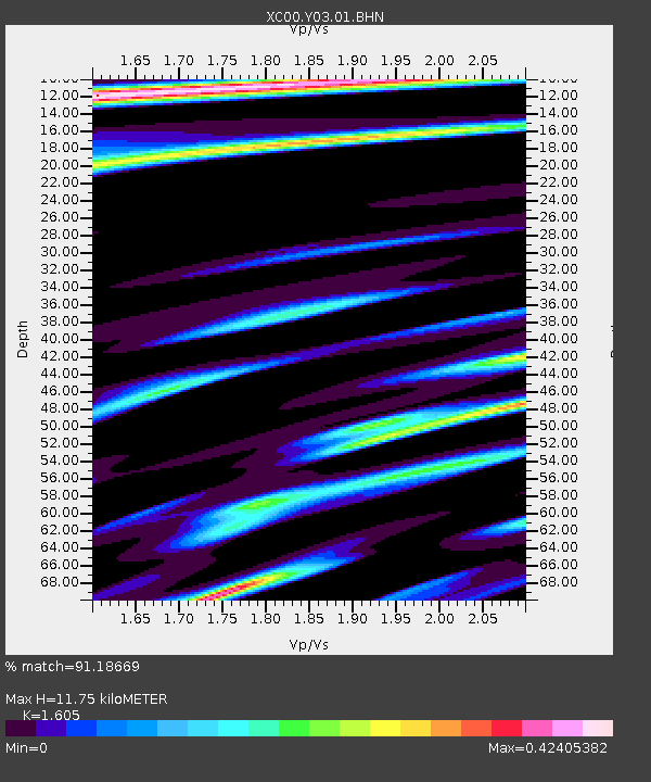
| PsPs/PpSs | 5.9 SECOND |

