
Y03 Y03 - Earthquake Result Viewer
| ||||||||||||||||||
| ||||||||||||||||||
| ||||||||||||||||||
|
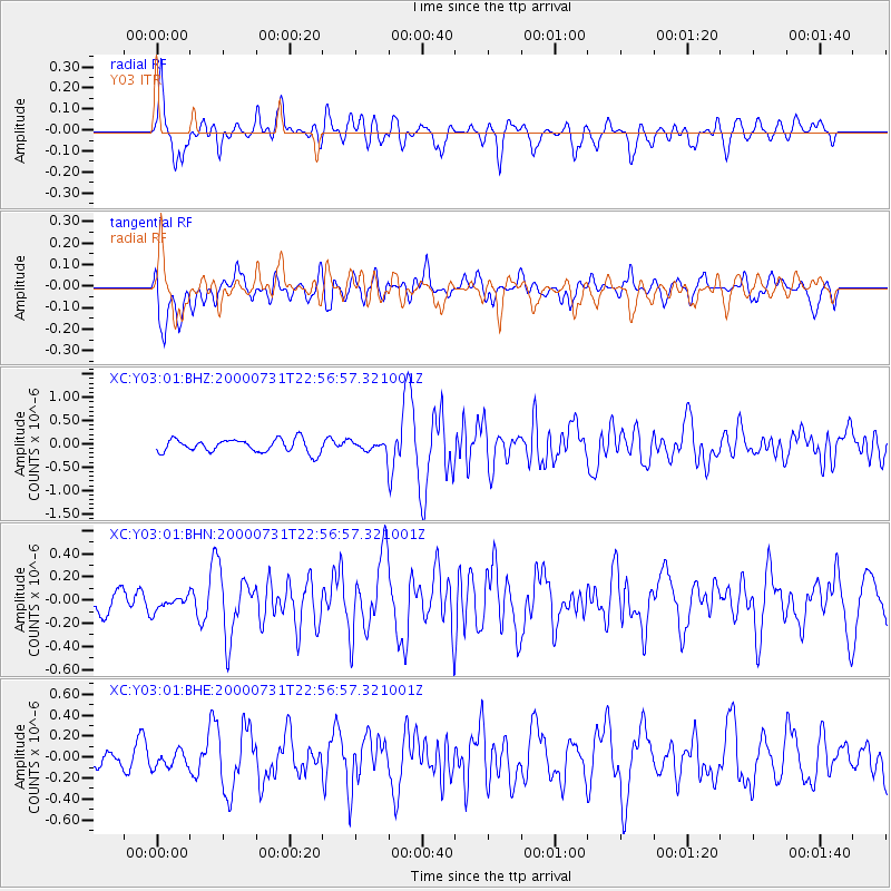
Signal To Noise
| Channel | StoN | STA | LTA |
| XC:Y03:01:BHN:20000731T22:56:57.321001Z | 0.57914525 | 6.348973E-8 | 1.0962662E-7 |
| XC:Y03:01:BHE:20000731T22:56:57.321001Z | 1.0347782 | 7.83584E-8 | 7.572481E-8 |
| XC:Y03:01:BHZ:20000731T22:56:57.321001Z | 0.67263174 | 9.45265E-8 | 1.4053232E-7 |
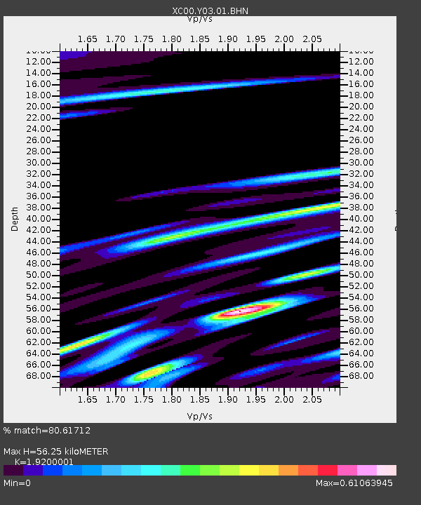
| Arrivals | |
| Ps | 8.4 SECOND |
| PpPs | 26 SECOND |
| PsPs/PpSs | 34 SECOND |

