Y03 Y03 - Earthquake Result Viewer
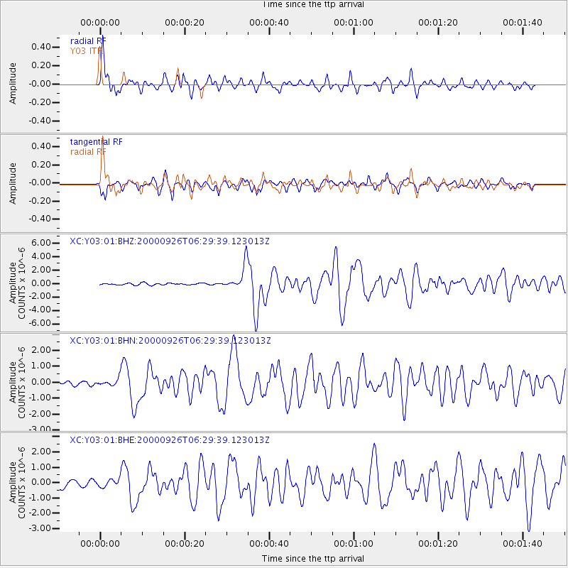
Earthquake location: Tonga Islands
Earthquake latitude/longitude: -17.2/-173.9
Earthquake time(UTC): 2000/09/26 (270) 06:17:52 GMT
Earthquake Depth: 56 km
Earthquake Magnitude: 6.1 MB, 6.1 MS, 6.4 MW, 6.1 ME
Earthquake Catalog/Contributor: WHDF/NEIC
Network: XC Yellowstone Intermountain Seismic Array
Station: Y03 Y03
Lat/Lon: 43.81 N/112.31 W
Elevation: 1478 m
Distance: 82.7 deg
Az: 39.95 deg
Baz: 237.975 deg
Ray Param: 0.046584513
Estimated Moho Depth: 19.5 km
Estimated Crust Vp/Vs: 1.61
Assumed Crust Vp: 6.279 km/s
Estimated Crust Vs: 3.912 km/s
Estimated Crust Poisson's Ratio: 0.18
Radial Match: 92.301636 %
Radial Bump: 373
Transverse Match: 88.061295 %
Transverse Bump: 400
SOD ConfigId: 16820
Insert Time: 2010-02-26 15:01:53.317 +0000
GWidth: 2.5
Max Bumps: 400
Tol: 0.001

Signal To Noise

ChannelStoNSTALTA
XC:Y03:01:BHN:20000926T06:29:39.123013Z2.28685432.5561536E-71.11775975E-7
XC:Y03:01:BHE:20000926T06:29:39.123013Z1.55243112.7692718E-71.7838292E-7
XC:Y03:01:BHZ:20000926T06:29:39.123013Z14.2916171.8767087E-61.3131535E-7
Arrivals
Ps1.9 SECOND
PpPs7.9 SECOND
PsPs/PpSs9.8 SECOND