
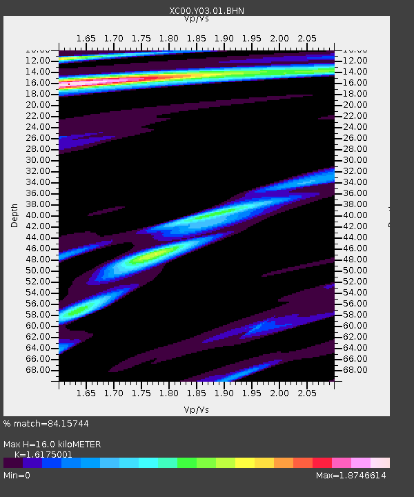
Y03 Y03 - Earthquake Result Viewer
| ||||||||||||||||||
| ||||||||||||||||||
| ||||||||||||||||||
|
Signal To Noise
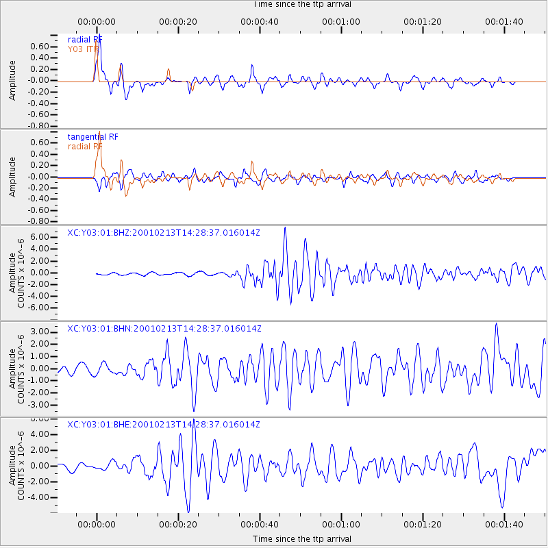
| Channel | StoN | STA | LTA |
| XC:Y03:01:BHN:20010213T14:28:37.016014Z | 1.666927 | 4.2516834E-7 | 2.5506117E-7 |
| XC:Y03:01:BHE:20010213T14:28:37.016014Z | 1.2524784 | 4.9288536E-7 | 3.9352804E-7 |
| XC:Y03:01:BHZ:20010213T14:28:37.016014Z | 1.2820643 | 2.6034365E-7 | 2.03066E-7 |
| Arrivals | |
| Ps | 1.7 SECOND |
| PpPs | 6.2 SECOND |
| PsPs/PpSs | 7.9 SECOND |

