Y24 Y24 - Earthquake Result Viewer
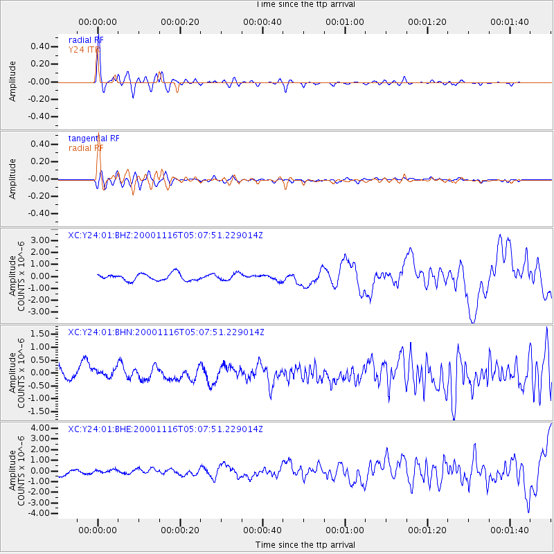
Earthquake location: New Ireland Region, P.N.G.
Earthquake latitude/longitude: -4.0/152.2
Earthquake time(UTC): 2000/11/16 (321) 04:54:56 GMT
Earthquake Depth: 33 km
Earthquake Magnitude: 6.0 MB, 8.2 MS, 8.0 MW, 8.0 ME
Earthquake Catalog/Contributor: WHDF/NEIC
Network: XC Yellowstone Intermountain Seismic Array
Station: Y24 Y24
Lat/Lon: 45.98 N/112.62 W
Elevation: 1741 m
Distance: 96.5 deg
Az: 44.335 deg
Baz: 270.976 deg
Ray Param: 0.040490303
Estimated Moho Depth: 36.25 km
Estimated Crust Vp/Vs: 1.89
Assumed Crust Vp: 6.577 km/s
Estimated Crust Vs: 3.48 km/s
Estimated Crust Poisson's Ratio: 0.31
Radial Match: 86.658264 %
Radial Bump: 400
Transverse Match: 60.911808 %
Transverse Bump: 400
SOD ConfigId: 16820
Insert Time: 2010-02-26 15:02:03.042 +0000
GWidth: 2.5
Max Bumps: 400
Tol: 0.001

Signal To Noise

ChannelStoNSTALTA
XC:Y24:01:BHN:20001116T05:07:51.229014Z1.02801423.192632E-73.1056305E-7
XC:Y24:01:BHE:20001116T05:07:51.229014Z0.419608151.2133204E-72.8915557E-7
XC:Y24:01:BHZ:20001116T05:07:51.229014Z0.98942342.807485E-72.837496E-7
Arrivals
Ps5.0 SECOND
PpPs16 SECOND
PsPs/PpSs21 SECOND