Y24 Y24 - Earthquake Result Viewer
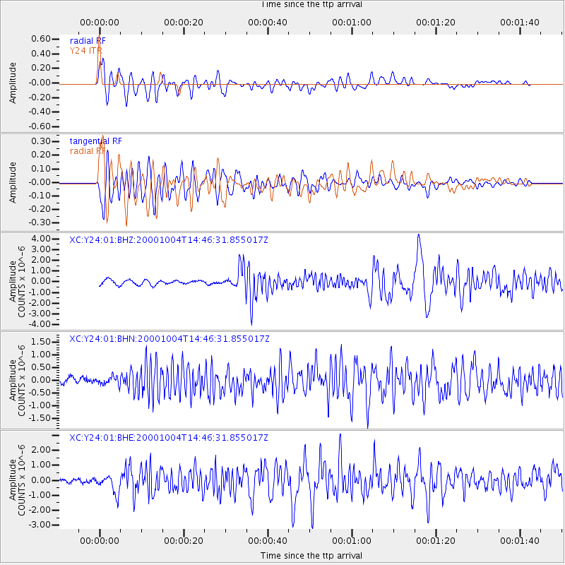
Earthquake location: Windward Islands
Earthquake latitude/longitude: 11.1/-62.6
Earthquake time(UTC): 2000/10/04 (278) 14:37:44 GMT
Earthquake Depth: 110 km
Earthquake Magnitude: 5.6 MB, 5.4 MS, 6.1 MW, 5.9 MD
Earthquake Catalog/Contributor: WHDF/NEIC
Network: XC Yellowstone Intermountain Seismic Array
Station: Y24 Y24
Lat/Lon: 45.98 N/112.62 W
Elevation: 1741 m
Distance: 54.8 deg
Az: 319.124 deg
Baz: 112.91 deg
Ray Param: 0.06488285
Estimated Moho Depth: 46.25 km
Estimated Crust Vp/Vs: 1.63
Assumed Crust Vp: 6.577 km/s
Estimated Crust Vs: 4.041 km/s
Estimated Crust Poisson's Ratio: 0.20
Radial Match: 88.83263 %
Radial Bump: 400
Transverse Match: 82.65214 %
Transverse Bump: 400
SOD ConfigId: 16820
Insert Time: 2010-02-26 15:02:06.096 +0000
GWidth: 2.5
Max Bumps: 400
Tol: 0.001

Signal To Noise

ChannelStoNSTALTA
XC:Y24:01:BHN:20001004T14:46:31.855017Z0.791394951.5769398E-71.9926078E-7
XC:Y24:01:BHE:20001004T14:46:31.855017Z3.0352136.083384E-72.0042694E-7
XC:Y24:01:BHZ:20001004T14:46:31.855017Z4.81733371.015662E-62.1083488E-7
Arrivals
Ps4.7 SECOND
PpPs17 SECOND
PsPs/PpSs22 SECOND