Y24 Y24 - Earthquake Result Viewer
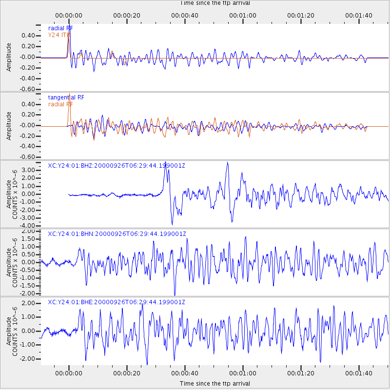
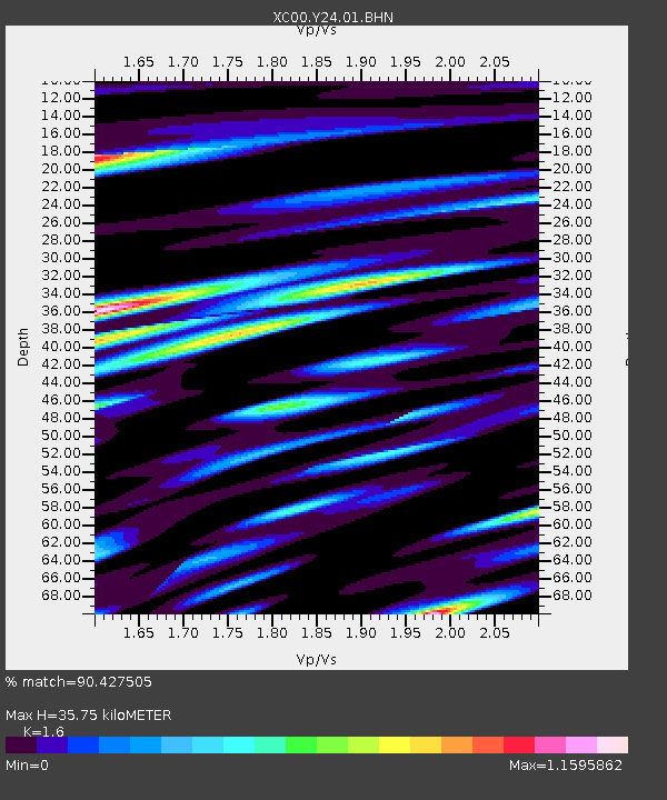
Earthquake location: Tonga Islands
Earthquake latitude/longitude: -17.2/-173.9
Earthquake time(UTC): 2000/09/26 (270) 06:17:52 GMT
Earthquake Depth: 56 km
Earthquake Magnitude: 6.1 MB, 6.1 MS, 6.4 MW, 6.1 ME
Earthquake Catalog/Contributor: WHDF/NEIC
Network: XC Yellowstone Intermountain Seismic Array
Station: Y24 Y24
Lat/Lon: 45.98 N/112.62 W
Elevation: 1741 m
Distance: 83.7 deg
Az: 37.981 deg
Baz: 237.531 deg
Ray Param: 0.045892995
Estimated Moho Depth: 35.75 km
Estimated Crust Vp/Vs: 1.60
Assumed Crust Vp: 6.577 km/s
Estimated Crust Vs: 4.111 km/s
Estimated Crust Poisson's Ratio: 0.18
Radial Match: 90.427505 %
Radial Bump: 400
Transverse Match: 79.08063 %
Transverse Bump: 400
SOD ConfigId: 16820
Insert Time: 2010-02-26 15:02:08.181 +0000
GWidth: 2.5
Max Bumps: 400
Tol: 0.001

Signal To Noise

ChannelStoNSTALTA
XC:Y24:01:BHN:20000926T06:29:44.199001Z2.45604663.8579037E-71.5707779E-7
XC:Y24:01:BHE:20000926T06:29:44.199001Z3.13635165.916908E-71.8865578E-7
XC:Y24:01:BHZ:20000926T06:29:44.199001Z17.9423581.736512E-69.678282E-8
Arrivals
Ps3.4 SECOND
PpPs14 SECOND
PsPs/PpSs17 SECOND