
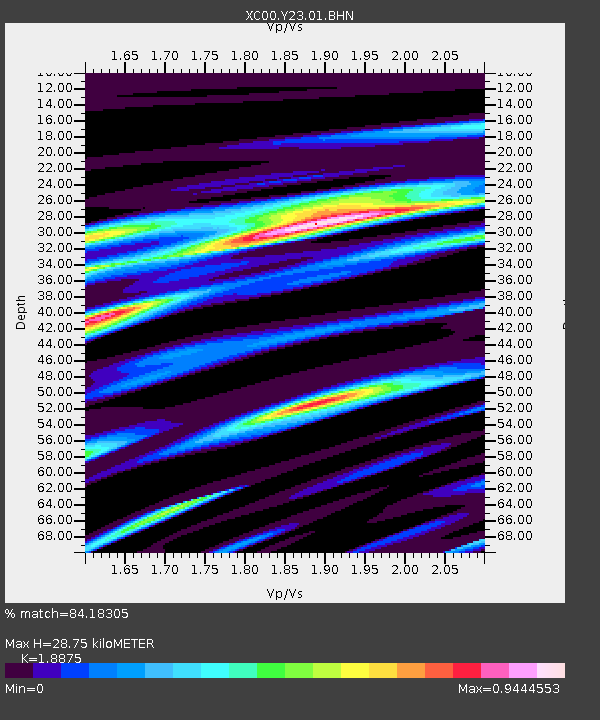
Y23 Y23 - Earthquake Result Viewer
| ||||||||||||||||||
| ||||||||||||||||||
| ||||||||||||||||||
|
Signal To Noise
| Channel | StoN | STA | LTA |
| XC:Y23:01:BHN:20001204T04:49:29.561008Z | 1.9778403 | 3.1434752E-7 | 1.5893474E-7 |
| XC:Y23:01:BHE:20001204T04:49:29.561008Z | 2.3201144 | 4.3163814E-7 | 1.8604175E-7 |
| XC:Y23:01:BHZ:20001204T04:49:29.561008Z | 2.3609664 | 6.792204E-7 | 2.8768744E-7 |
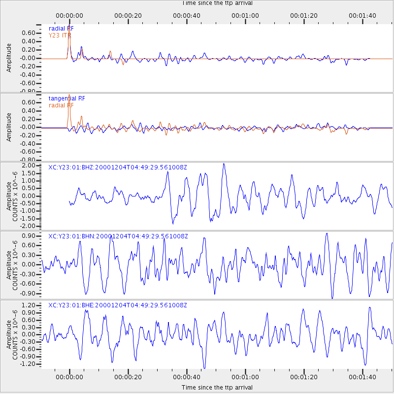
| Arrivals | |
| Ps | 4.3 SECOND |
| PpPs | 12 SECOND |
| PsPs/PpSs | 16 SECOND |

