
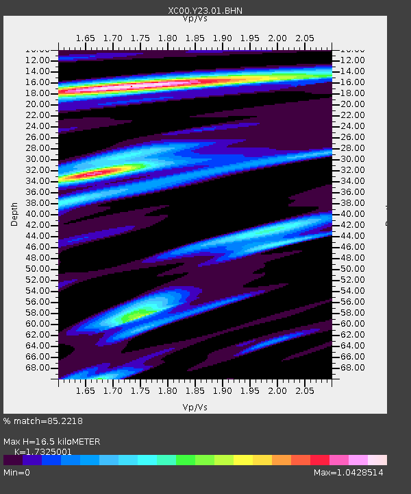
Y23 Y23 - Earthquake Result Viewer
| ||||||||||||||||||
| ||||||||||||||||||
| ||||||||||||||||||
|
Signal To Noise
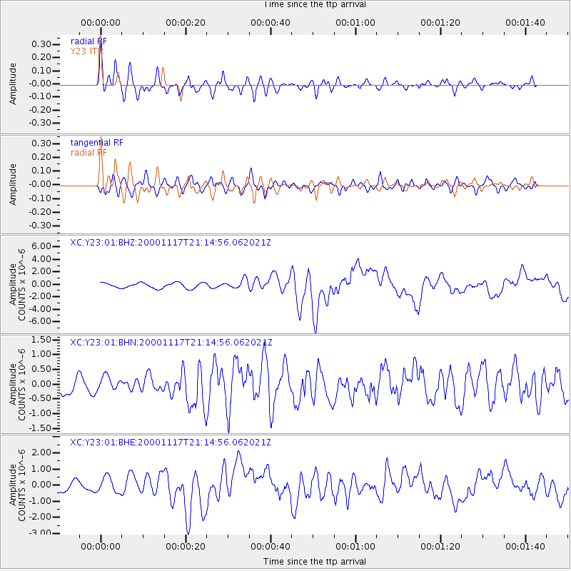
| Channel | StoN | STA | LTA |
| XC:Y23:01:BHN:20001117T21:14:56.062021Z | 0.8051379 | 2.4986915E-7 | 3.103433E-7 |
| XC:Y23:01:BHE:20001117T21:14:56.062021Z | 2.1060426 | 4.85033E-7 | 2.3030539E-7 |
| XC:Y23:01:BHZ:20001117T21:14:56.062021Z | 1.7322118 | 7.4015355E-7 | 4.2728814E-7 |
| Arrivals | |
| Ps | 1.9 SECOND |
| PpPs | 7.0 SECOND |
| PsPs/PpSs | 8.9 SECOND |

