Y23 Y23 - Earthquake Result Viewer
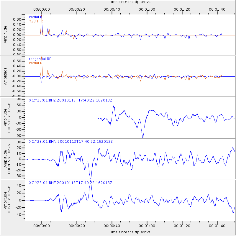
Earthquake location: El Salvador
Earthquake latitude/longitude: 13.0/-88.7
Earthquake time(UTC): 2001/01/13 (013) 17:33:32 GMT
Earthquake Depth: 60 km
Earthquake Magnitude: 6.4 MB, 7.8 MS, 7.7 MW, 7.5 ME
Earthquake Catalog/Contributor: WHDF/NEIC
Network: XC Yellowstone Intermountain Seismic Array
Station: Y23 Y23
Lat/Lon: 46.28 N/112.93 W
Elevation: 1651 m
Distance: 38.9 deg
Az: 333.032 deg
Baz: 140.417 deg
Ray Param: 0.07510166
Estimated Moho Depth: 35.75 km
Estimated Crust Vp/Vs: 1.60
Assumed Crust Vp: 6.353 km/s
Estimated Crust Vs: 3.971 km/s
Estimated Crust Poisson's Ratio: 0.18
Radial Match: 94.23593 %
Radial Bump: 290
Transverse Match: 88.28487 %
Transverse Bump: 400
SOD ConfigId: 16820
Insert Time: 2010-02-26 15:02:29.862 +0000
GWidth: 2.5
Max Bumps: 400
Tol: 0.001

Signal To Noise

ChannelStoNSTALTA
XC:Y23:01:BHN:20010113T17:40:22.162013Z1.03008959.768104E-79.482772E-7
XC:Y23:01:BHE:20010113T17:40:22.162013Z1.73773181.64989E-69.4945034E-7
XC:Y23:01:BHZ:20010113T17:40:22.162013Z7.8243723.2986568E-64.2158743E-7
Arrivals
Ps3.6 SECOND
PpPs14 SECOND
PsPs/PpSs17 SECOND