
Y05 Y05 - Earthquake Result Viewer
| ||||||||||||||||||
| ||||||||||||||||||
| ||||||||||||||||||
|
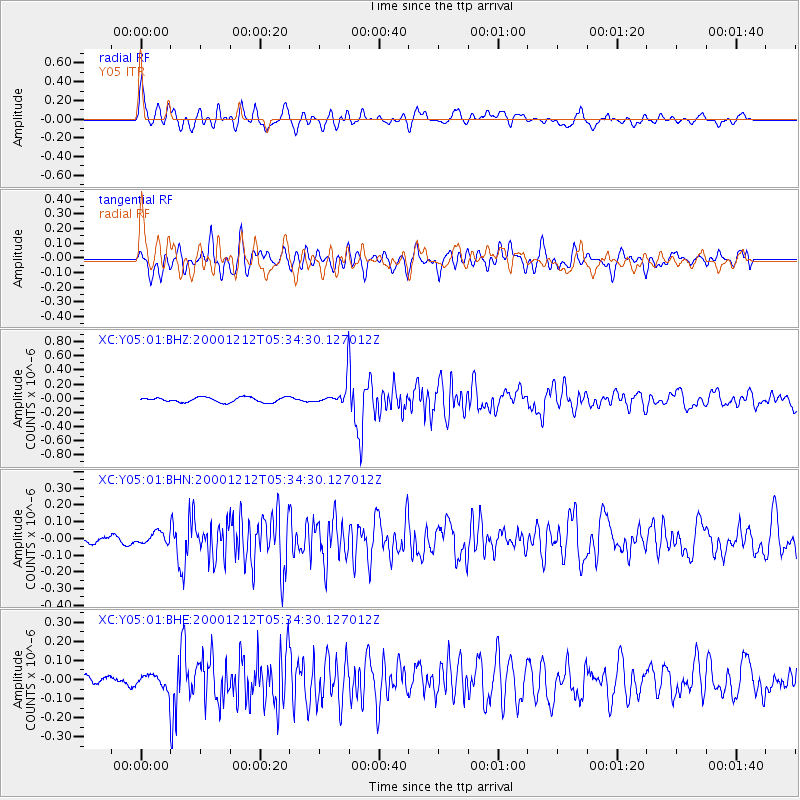
Signal To Noise
| Channel | StoN | STA | LTA |
| XC:Y05:01:BHN:20001212T05:34:30.127012Z | 1.4990872 | 3.2821422E-8 | 2.189427E-8 |
| XC:Y05:01:BHE:20001212T05:34:30.127012Z | 1.3360827 | 4.701123E-8 | 3.518587E-8 |
| XC:Y05:01:BHZ:20001212T05:34:30.127012Z | 3.767855 | 1.3059366E-7 | 3.4659948E-8 |
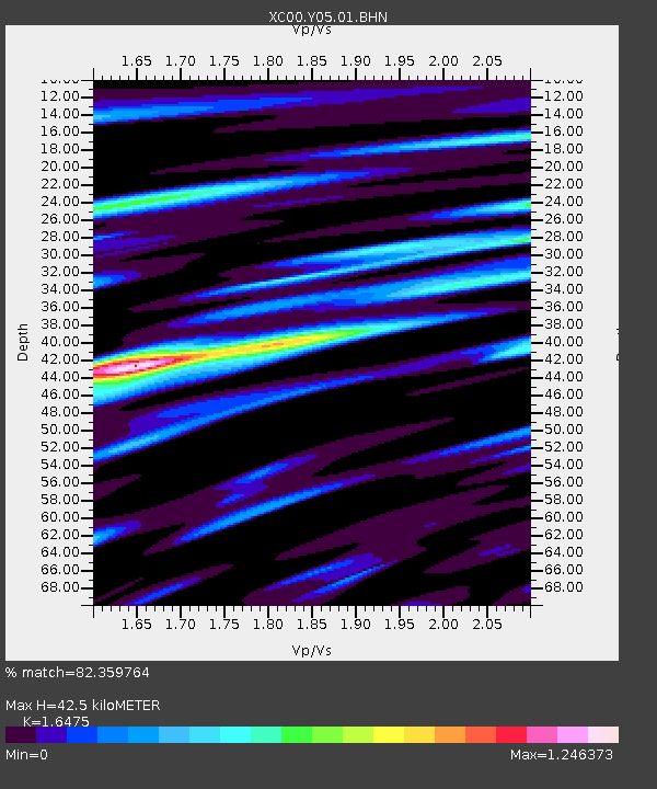
| Arrivals | |
| Ps | 4.7 SECOND |
| PpPs | 17 SECOND |
| PsPs/PpSs | 22 SECOND |

