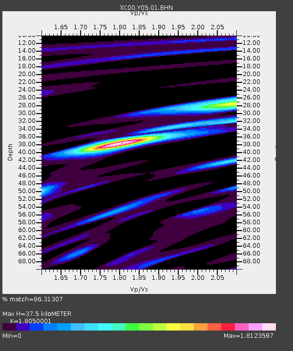
Y05 Y05 - Earthquake Result Viewer
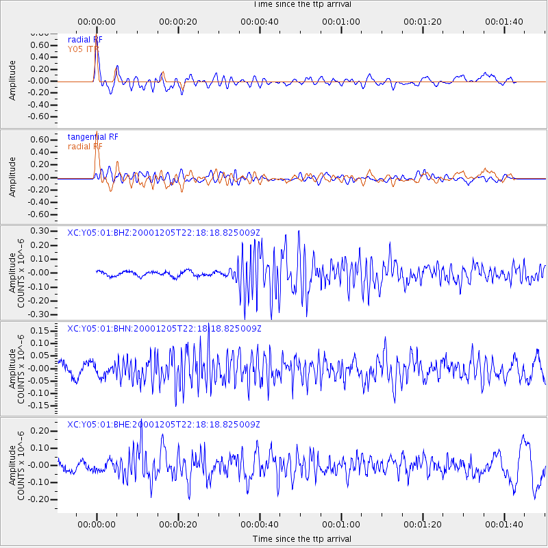
Earthquake location: Fox Islands, Aleutian Islands
Earthquake latitude/longitude: 52.6/-167.8
Earthquake time(UTC): 2000/12/05 (340) 22:11:34 GMT
Earthquake Depth: 33 km
Earthquake Magnitude: 5.6 MB, 5.6 MS, 5.9 MW, 5.4 ML
Earthquake Catalog/Contributor: WHDF/NEIC
Network: XC Yellowstone Intermountain Seismic Array
Station: Y05 Y05
Lat/Lon: 43.19 N/111.58 W
Elevation: 1970 m
Distance: 38.0 deg
Az: 81.179 deg
Baz: 304.461 deg
Ray Param: 0.0757569
Estimated Moho Depth: 37.5 km
Estimated Crust Vp/Vs: 1.81
Assumed Crust Vp: 6.207 km/s
Estimated Crust Vs: 3.439 km/s
Estimated Crust Poisson's Ratio: 0.28
Radial Match: 86.31307 %
Radial Bump: 400
Transverse Match: 71.27967 %
Transverse Bump: 400
SOD ConfigId: 16820
Insert Time: 2010-02-26 15:02:33.748 +0000
GWidth: 2.5
Max Bumps: 400
Tol: 0.001

Signal To Noise

ChannelStoNSTALTA
XC:Y05:01:BHN:20001205T22:18:18.825009Z0.81584682.2479695E-82.7553819E-8
XC:Y05:01:BHE:20001205T22:18:18.825009Z1.29345832.76785E-82.1398833E-8
XC:Y05:01:BHZ:20001205T22:18:18.825009Z1.88737333.3710446E-81.7861037E-8
Arrivals
Ps5.2 SECOND
PpPs16 SECOND
PsPs/PpSs21 SECOND