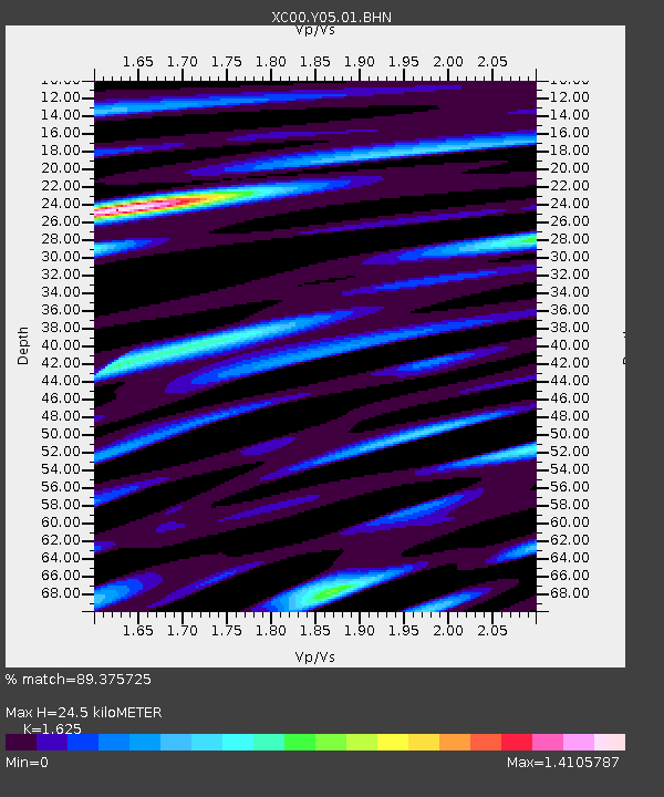
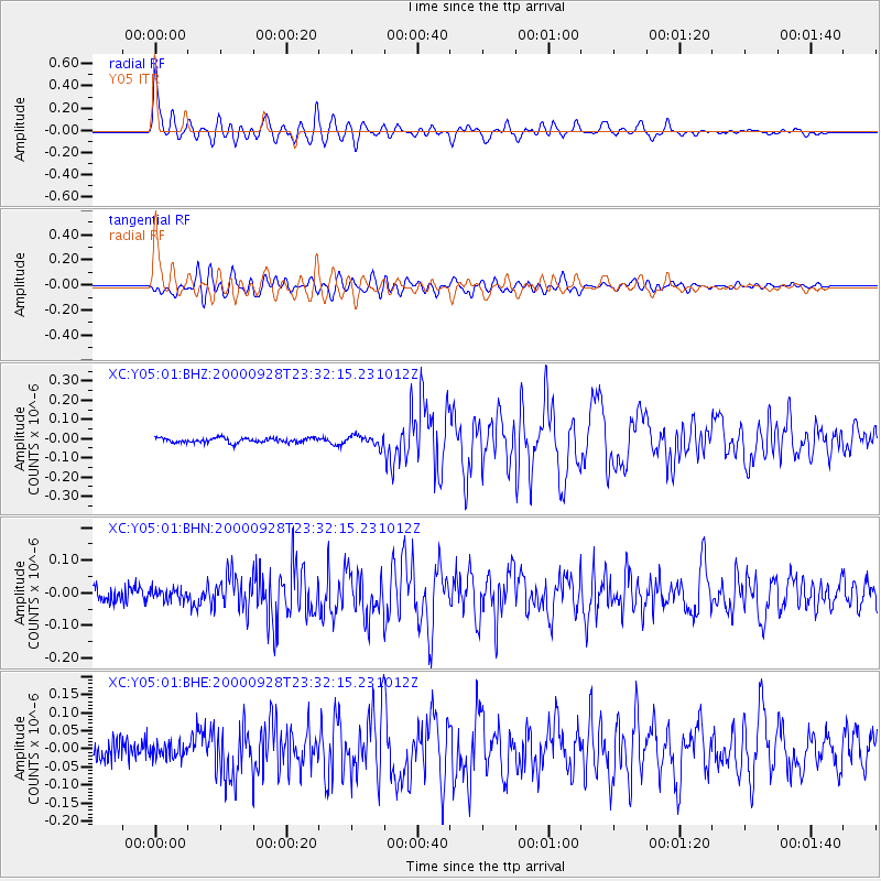
Y05 Y05 - Earthquake Result Viewer

Earthquake location: Near Coast Of Ecuador
Earthquake latitude/longitude: -0.2/-80.6
Earthquake time(UTC): 2000/09/28 (272) 23:23:43 GMT
Earthquake Depth: 23 km
Earthquake Magnitude: 5.8 MB, 6.0 MS, 6.6 MW, 6.4 MW
Earthquake Catalog/Contributor: WHDF/NEIC
Network: XC Yellowstone Intermountain Seismic Array
Station: Y05 Y05
Lat/Lon: 43.19 N/111.58 W
Elevation: 1970 m
Distance: 51.4 deg
Az: 331.166 deg
Baz: 138.748 deg
Ray Param: 0.06742923
Estimated Moho Depth: 24.5 km
Estimated Crust Vp/Vs: 1.62
Assumed Crust Vp: 6.207 km/s
Estimated Crust Vs: 3.82 km/s
Estimated Crust Poisson's Ratio: 0.20
Radial Match: 89.375725 %
Radial Bump: 400
Transverse Match: 80.41322 %
Transverse Bump: 400
SOD ConfigId: 3744
Insert Time: 2010-02-26 15:02:37.504 +0000
GWidth: 2.5
Max Bumps: 400
Tol: 0.001

Signal To Noise

ChannelStoNSTALTA
XC:Y05:01:BHN:20000928T23:32:15.231012Z0.79200881.7033715E-82.1506976E-8
XC:Y05:01:BHE:20000928T23:32:15.231012Z0.771922351.9923784E-82.5810605E-8
XC:Y05:01:BHZ:20000928T23:32:15.231012Z2.05980042.5810788E-81.2530723E-8
Arrivals
Ps2.6 SECOND
PpPs9.8 SECOND
PsPs/PpSs12 SECOND