Y05 Y05 - Earthquake Result Viewer
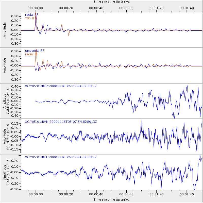
Earthquake location: New Ireland Region, P.N.G.
Earthquake latitude/longitude: -4.0/152.2
Earthquake time(UTC): 2000/11/16 (321) 04:54:56 GMT
Earthquake Depth: 33 km
Earthquake Magnitude: 6.0 MB, 8.2 MS, 8.0 MW, 8.0 ME
Earthquake Catalog/Contributor: WHDF/NEIC
Network: XC Yellowstone Intermountain Seismic Array
Station: Y05 Y05
Lat/Lon: 43.19 N/111.58 W
Elevation: 1970 m
Distance: 97.3 deg
Az: 47.133 deg
Baz: 271.364 deg
Ray Param: 0.040250786
Estimated Moho Depth: 29.0 km
Estimated Crust Vp/Vs: 2.03
Assumed Crust Vp: 6.207 km/s
Estimated Crust Vs: 3.054 km/s
Estimated Crust Poisson's Ratio: 0.34
Radial Match: 89.243706 %
Radial Bump: 341
Transverse Match: 76.34466 %
Transverse Bump: 400
SOD ConfigId: 16820
Insert Time: 2010-02-26 15:02:39.510 +0000
GWidth: 2.5
Max Bumps: 400
Tol: 0.001

Signal To Noise

ChannelStoNSTALTA
XC:Y05:01:BHN:20001116T05:07:54.828013Z1.01404172.5186239E-82.483748E-8
XC:Y05:01:BHE:20001116T05:07:54.828013Z1.01419322.5136336E-82.4784566E-8
XC:Y05:01:BHZ:20001116T05:07:54.828013Z0.73242611.5281584E-82.0864334E-8
Arrivals
Ps4.9 SECOND
PpPs14 SECOND
PsPs/PpSs19 SECOND