Y05 Y05 - Earthquake Result Viewer
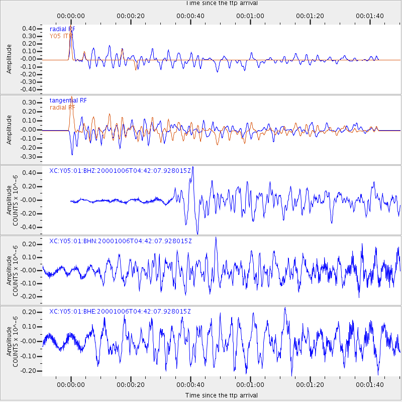
Earthquake location: Western Honshu, Japan
Earthquake latitude/longitude: 35.5/133.1
Earthquake time(UTC): 2000/10/06 (280) 04:30:19 GMT
Earthquake Depth: 10 km
Earthquake Magnitude: 5.8 MB, 6.8 MS, 7.0 ME, 6.7 MW
Earthquake Catalog/Contributor: WHDF/NEIC
Network: XC Yellowstone Intermountain Seismic Array
Station: Y05 Y05
Lat/Lon: 43.19 N/111.58 W
Elevation: 1970 m
Distance: 82.0 deg
Az: 41.898 deg
Baz: 311.806 deg
Ray Param: 0.04717655
Estimated Moho Depth: 64.0 km
Estimated Crust Vp/Vs: 1.73
Assumed Crust Vp: 6.207 km/s
Estimated Crust Vs: 3.593 km/s
Estimated Crust Poisson's Ratio: 0.25
Radial Match: 82.475266 %
Radial Bump: 400
Transverse Match: 75.32435 %
Transverse Bump: 400
SOD ConfigId: 16820
Insert Time: 2010-02-26 15:02:40.488 +0000
GWidth: 2.5
Max Bumps: 400
Tol: 0.001

Signal To Noise

ChannelStoNSTALTA
XC:Y05:01:BHN:20001006T04:42:07.928015Z0.863476162.974231E-83.4444852E-8
XC:Y05:01:BHE:20001006T04:42:07.928015Z1.1605543.8946432E-83.3558482E-8
XC:Y05:01:BHZ:20001006T04:42:07.928015Z2.71538664.342699E-81.5992931E-8
Arrivals
Ps7.7 SECOND
PpPs27 SECOND
PsPs/PpSs35 SECOND