Y05 Y05 - Earthquake Result Viewer
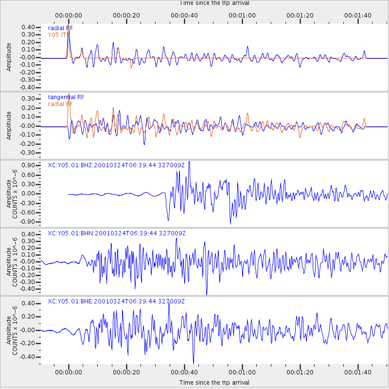
Earthquake location: Western Honshu, Japan
Earthquake latitude/longitude: 34.1/132.5
Earthquake time(UTC): 2001/03/24 (083) 06:27:53 GMT
Earthquake Depth: 50 km
Earthquake Magnitude: 6.4 MB, 6.5 MS, 6.8 MW, 6.4 ME
Earthquake Catalog/Contributor: WHDF/NEIC
Network: XC Yellowstone Intermountain Seismic Array
Station: Y05 Y05
Lat/Lon: 43.19 N/111.58 W
Elevation: 1970 m
Distance: 83.4 deg
Az: 41.484 deg
Baz: 311.264 deg
Ray Param: 0.046144273
Estimated Moho Depth: 57.5 km
Estimated Crust Vp/Vs: 2.05
Assumed Crust Vp: 6.207 km/s
Estimated Crust Vs: 3.028 km/s
Estimated Crust Poisson's Ratio: 0.34
Radial Match: 86.87128 %
Radial Bump: 400
Transverse Match: 83.94768 %
Transverse Bump: 400
SOD ConfigId: 4714
Insert Time: 2010-02-26 15:02:44.897 +0000
GWidth: 2.5
Max Bumps: 400
Tol: 0.001

Signal To Noise

ChannelStoNSTALTA
XC:Y05:01:BHN:20010324T06:39:44.327009Z1.49709463.5572278E-82.3760872E-8
XC:Y05:01:BHE:20010324T06:39:44.327009Z2.35165796.193529E-82.6336863E-8
XC:Y05:01:BHZ:20010324T06:39:44.327009Z13.1419742.9008874E-72.2073452E-8
Arrivals
Ps9.9 SECOND
PpPs28 SECOND
PsPs/PpSs38 SECOND