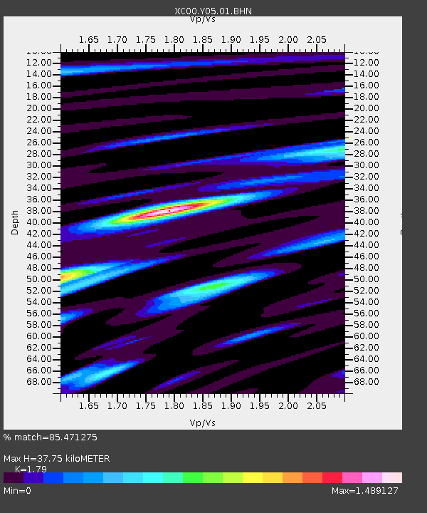
Y05 Y05 - Earthquake Result Viewer
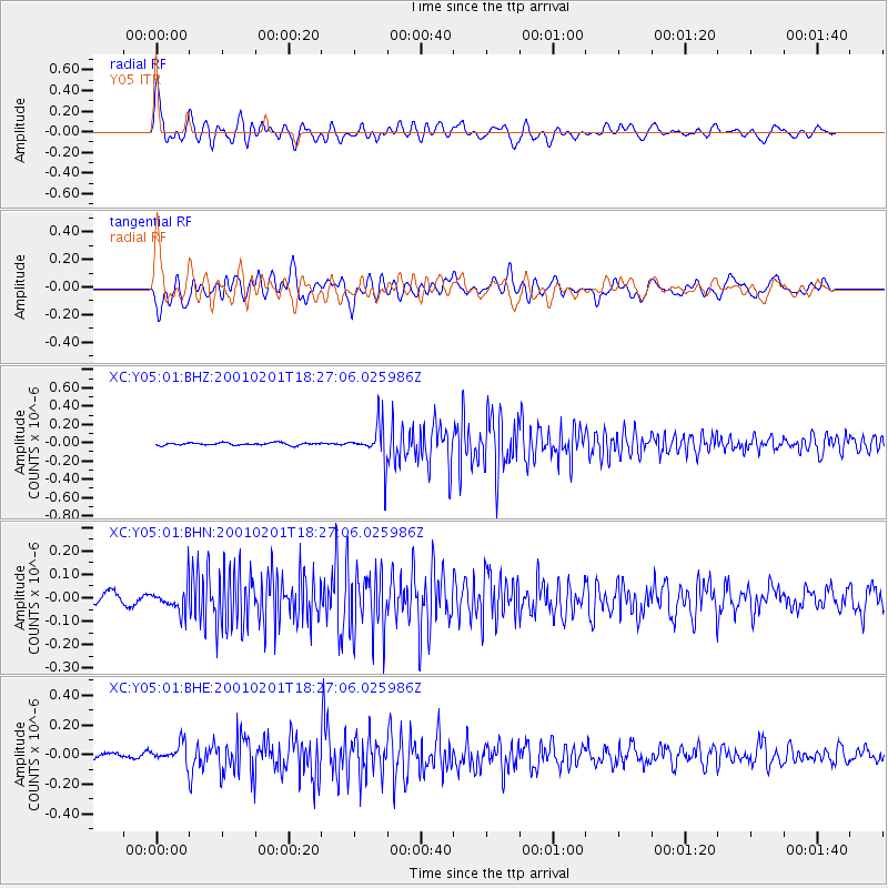
Earthquake location: Andreanof Islands, Aleutian Is.
Earthquake latitude/longitude: 51.4/-177.8
Earthquake time(UTC): 2001/02/01 (032) 18:19:30 GMT
Earthquake Depth: 33 km
Earthquake Magnitude: 5.6 MB, 5.6 MS, 6.0 MW, 5.9 MW
Earthquake Catalog/Contributor: WHDF/NEIC
Network: XC Yellowstone Intermountain Seismic Array
Station: Y05 Y05
Lat/Lon: 43.19 N/111.58 W
Elevation: 1970 m
Distance: 44.2 deg
Az: 73.614 deg
Baz: 304.811 deg
Ray Param: 0.071977265
Estimated Moho Depth: 37.75 km
Estimated Crust Vp/Vs: 1.79
Assumed Crust Vp: 6.207 km/s
Estimated Crust Vs: 3.467 km/s
Estimated Crust Poisson's Ratio: 0.27
Radial Match: 85.471275 %
Radial Bump: 400
Transverse Match: 75.99598 %
Transverse Bump: 400
SOD ConfigId: 16820
Insert Time: 2010-02-26 15:02:46.035 +0000
GWidth: 2.5
Max Bumps: 400
Tol: 0.001

Signal To Noise

ChannelStoNSTALTA
XC:Y05:01:BHN:20010201T18:27:06.025986Z2.22471675.4745488E-82.4607848E-8
XC:Y05:01:BHE:20010201T18:27:06.025986Z3.84234746.5030015E-81.6924554E-8
XC:Y05:01:BHZ:20010201T18:27:06.025986Z15.8720882.1343041E-71.3446901E-8
Arrivals
Ps5.1 SECOND
PpPs16 SECOND
PsPs/PpSs21 SECOND