
Y05 Y05 - Earthquake Result Viewer
| ||||||||||||||||||
| ||||||||||||||||||
| ||||||||||||||||||
|
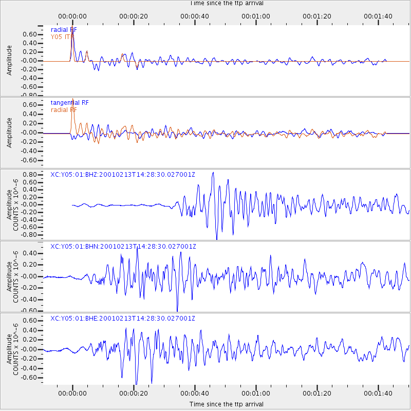
Signal To Noise
| Channel | StoN | STA | LTA |
| XC:Y05:01:BHN:20010213T14:28:30.027001Z | 0.8306 | 2.7315203E-8 | 3.2886106E-8 |
| XC:Y05:01:BHE:20010213T14:28:30.027001Z | 1.9861393 | 4.272991E-8 | 2.1514055E-8 |
| XC:Y05:01:BHZ:20010213T14:28:30.027001Z | 2.5522602 | 4.6151083E-8 | 1.8082437E-8 |
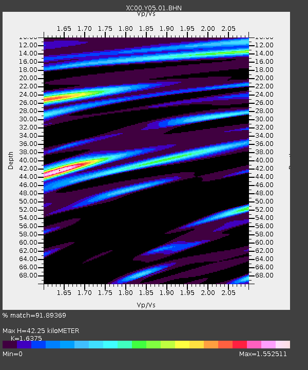
| Arrivals | |
| Ps | 4.7 SECOND |
| PpPs | 17 SECOND |
| PsPs/PpSs | 21 SECOND |

