
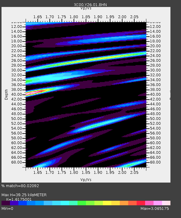
Y26 Y26 - Earthquake Result Viewer
| ||||||||||||||||||
| ||||||||||||||||||
| ||||||||||||||||||
|
Signal To Noise
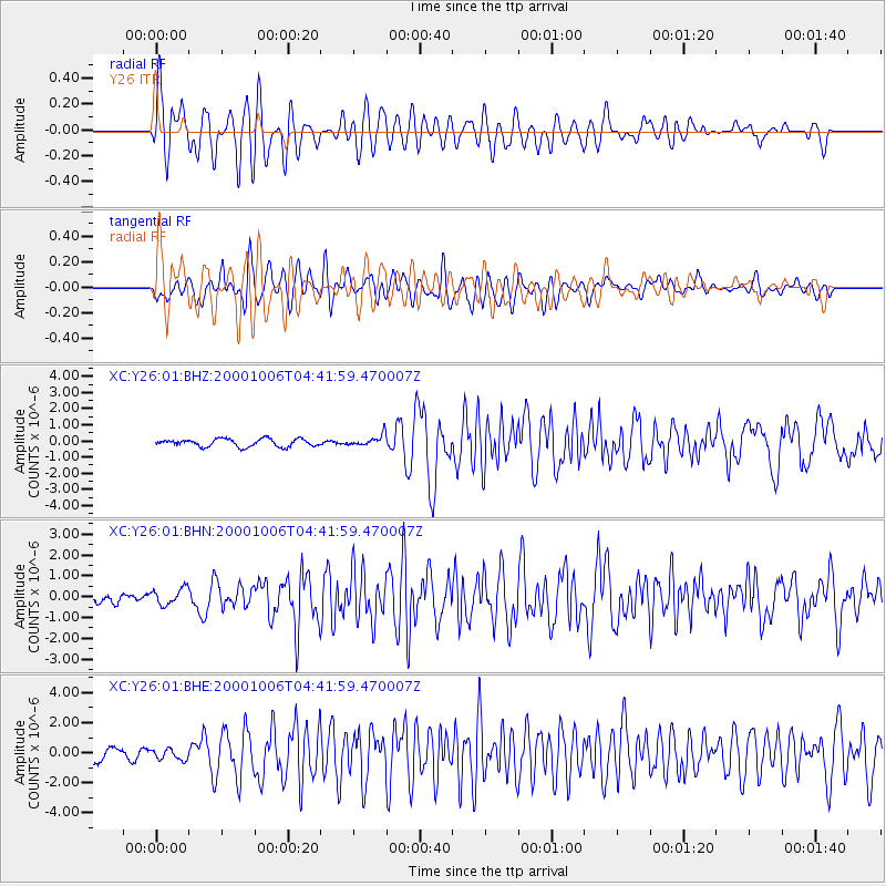
| Channel | StoN | STA | LTA |
| XC:Y26:01:BHN:20001006T04:41:59.470007Z | 1.4050342 | 3.9256318E-7 | 2.793976E-7 |
| XC:Y26:01:BHE:20001006T04:41:59.470007Z | 0.80680454 | 3.5293834E-7 | 4.374521E-7 |
| XC:Y26:01:BHZ:20001006T04:41:59.470007Z | 1.4011184 | 3.3444982E-7 | 2.3870203E-7 |
| Arrivals | |
| Ps | 3.9 SECOND |
| PpPs | 16 SECOND |
| PsPs/PpSs | 20 SECOND |

