Y26 Y26 - Earthquake Result Viewer
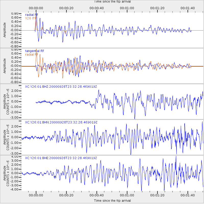
Earthquake location: Near Coast Of Ecuador
Earthquake latitude/longitude: -0.2/-80.6
Earthquake time(UTC): 2000/09/28 (272) 23:23:43 GMT
Earthquake Depth: 23 km
Earthquake Magnitude: 5.8 MB, 6.0 MS, 6.6 MW, 6.4 MW
Earthquake Catalog/Contributor: WHDF/NEIC
Network: XC Yellowstone Intermountain Seismic Array
Station: Y26 Y26
Lat/Lon: 45.45 N/111.75 W
Elevation: 1529 m
Distance: 53.2 deg
Az: 332.918 deg
Baz: 139.704 deg
Ray Param: 0.06625729
Estimated Moho Depth: 30.0 km
Estimated Crust Vp/Vs: 1.93
Assumed Crust Vp: 6.35 km/s
Estimated Crust Vs: 3.294 km/s
Estimated Crust Poisson's Ratio: 0.32
Radial Match: 88.71668 %
Radial Bump: 400
Transverse Match: 82.04234 %
Transverse Bump: 400
SOD ConfigId: 16820
Insert Time: 2010-02-26 15:02:56.414 +0000
GWidth: 2.5
Max Bumps: 400
Tol: 0.001

Signal To Noise

ChannelStoNSTALTA
XC:Y26:01:BHN:20000928T23:32:28.469019Z0.476331381.2634457E-72.6524512E-7
XC:Y26:01:BHE:20000928T23:32:28.469019Z0.95031052.4069124E-72.532764E-7
XC:Y26:01:BHZ:20000928T23:32:28.469019Z1.16203921.6394765E-71.4108616E-7
Arrivals
Ps4.6 SECOND
PpPs13 SECOND
PsPs/PpSs18 SECOND