Y26 Y26 - Earthquake Result Viewer
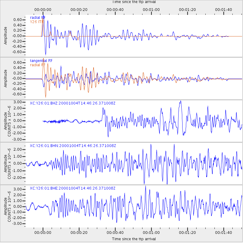
Earthquake location: Windward Islands
Earthquake latitude/longitude: 11.1/-62.6
Earthquake time(UTC): 2000/10/04 (278) 14:37:44 GMT
Earthquake Depth: 110 km
Earthquake Magnitude: 5.6 MB, 5.4 MS, 6.1 MW, 5.9 MD
Earthquake Catalog/Contributor: WHDF/NEIC
Network: XC Yellowstone Intermountain Seismic Array
Station: Y26 Y26
Lat/Lon: 45.45 N/111.75 W
Elevation: 1529 m
Distance: 54.0 deg
Az: 318.813 deg
Baz: 113.347 deg
Ray Param: 0.06538454
Estimated Moho Depth: 26.25 km
Estimated Crust Vp/Vs: 1.68
Assumed Crust Vp: 6.35 km/s
Estimated Crust Vs: 3.791 km/s
Estimated Crust Poisson's Ratio: 0.22
Radial Match: 88.16165 %
Radial Bump: 400
Transverse Match: 77.04303 %
Transverse Bump: 400
SOD ConfigId: 16820
Insert Time: 2010-02-26 15:02:58.493 +0000
GWidth: 2.5
Max Bumps: 400
Tol: 0.001

Signal To Noise

ChannelStoNSTALTA
XC:Y26:01:BHN:20001004T14:46:26.371008Z0.82100181.9668109E-72.395623E-7
XC:Y26:01:BHE:20001004T14:46:26.371008Z2.048646.4492065E-73.1480428E-7
XC:Y26:01:BHZ:20001004T14:46:26.371008Z6.4063748.7976696E-71.3732682E-7
Arrivals
Ps2.9 SECOND
PpPs10 SECOND
PsPs/PpSs13 SECOND