
Y26 Y26 - Earthquake Result Viewer
| ||||||||||||||||||
| ||||||||||||||||||
| ||||||||||||||||||
|
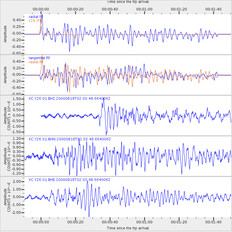
Signal To Noise
| Channel | StoN | STA | LTA |
| XC:Y26:01:BHN:20000818T02:03:48.664006Z | 1.0809144 | 1.3756998E-7 | 1.2727186E-7 |
| XC:Y26:01:BHE:20000818T02:03:48.664006Z | 1.2689648 | 2.0650836E-7 | 1.6273766E-7 |
| XC:Y26:01:BHZ:20000818T02:03:48.664006Z | 2.3858564 | 2.489728E-7 | 1.04353646E-7 |
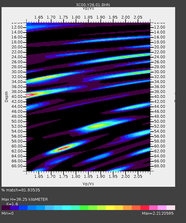
| Arrivals | |
| Ps | 3.8 SECOND |
| PpPs | 16 SECOND |
| PsPs/PpSs | 19 SECOND |

