Y61 Y61 - Earthquake Result Viewer
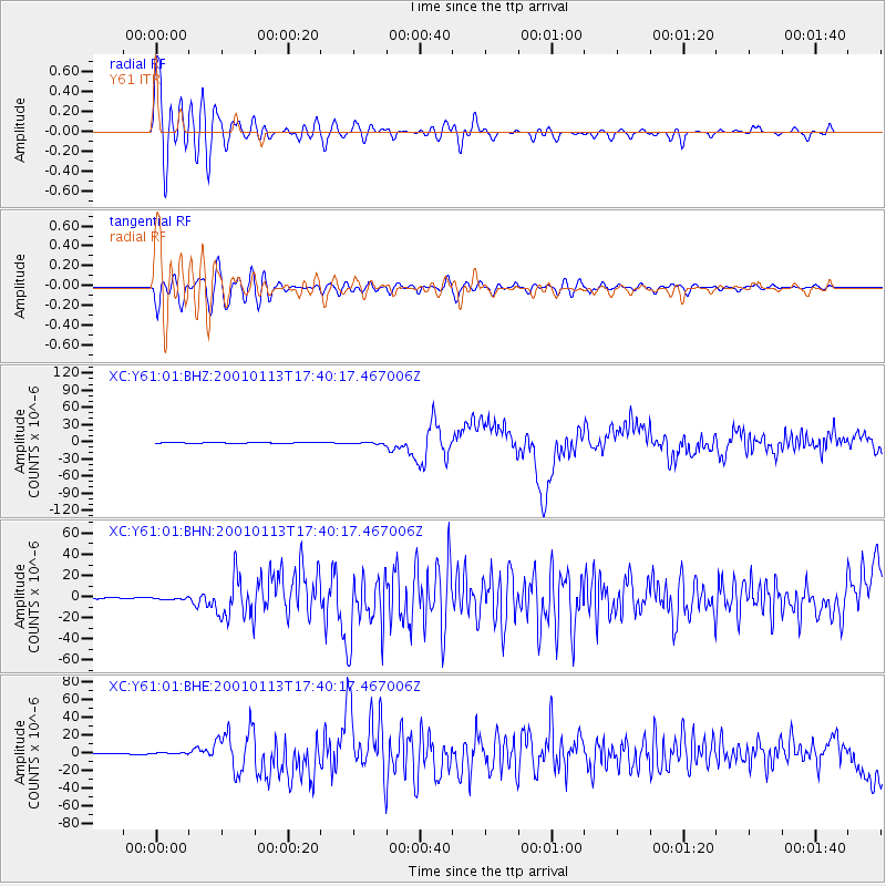
Earthquake location: El Salvador
Earthquake latitude/longitude: 13.0/-88.7
Earthquake time(UTC): 2001/01/13 (013) 17:33:32 GMT
Earthquake Depth: 60 km
Earthquake Magnitude: 6.4 MB, 7.8 MS, 7.7 MW, 7.5 ME
Earthquake Catalog/Contributor: WHDF/NEIC
Network: XC Yellowstone Intermountain Seismic Array
Station: Y61 Y61
Lat/Lon: 46.60 N/111.03 W
Elevation: 1510 m
Distance: 38.4 deg
Az: 334.997 deg
Baz: 143.322 deg
Ray Param: 0.07542469
Estimated Moho Depth: 62.0 km
Estimated Crust Vp/Vs: 1.68
Assumed Crust Vp: 6.306 km/s
Estimated Crust Vs: 3.754 km/s
Estimated Crust Poisson's Ratio: 0.23
Radial Match: 85.57614 %
Radial Bump: 400
Transverse Match: 70.511856 %
Transverse Bump: 400
SOD ConfigId: 16820
Insert Time: 2010-02-26 15:03:06.224 +0000
GWidth: 2.5
Max Bumps: 400
Tol: 0.001

Signal To Noise

ChannelStoNSTALTA
XC:Y61:01:BHN:20010113T17:40:17.467006Z1.68539089.4252056E-75.5922965E-7
XC:Y61:01:BHE:20010113T17:40:17.467006Z2.53134588.596612E-73.396064E-7
XC:Y61:01:BHZ:20010113T17:40:17.467006Z3.9660941.670775E-64.212646E-7
Arrivals
Ps7.2 SECOND
PpPs24 SECOND
PsPs/PpSs32 SECOND