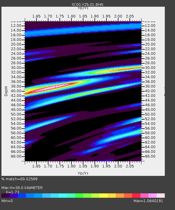
Y25 Y25 - Earthquake Result Viewer
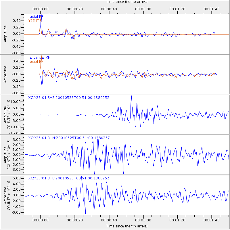
Earthquake location: Kuril Islands
Earthquake latitude/longitude: 44.3/148.4
Earthquake time(UTC): 2001/05/25 (145) 00:40:50 GMT
Earthquake Depth: 33 km
Earthquake Magnitude: 6.1 MB, 6.7 MS, 6.7 MW, 6.6 MW
Earthquake Catalog/Contributor: WHDF/NEIC
Network: XC Yellowstone Intermountain Seismic Array
Station: Y25 Y25
Lat/Lon: 45.71 N/112.18 W
Elevation: 1393 m
Distance: 65.6 deg
Az: 49.407 deg
Baz: 308.875 deg
Ray Param: 0.058142994
Estimated Moho Depth: 38.0 km
Estimated Crust Vp/Vs: 1.73
Assumed Crust Vp: 6.577 km/s
Estimated Crust Vs: 3.802 km/s
Estimated Crust Poisson's Ratio: 0.25
Radial Match: 88.02599 %
Radial Bump: 400
Transverse Match: 81.81272 %
Transverse Bump: 400
SOD ConfigId: 4714
Insert Time: 2010-02-26 15:03:19.449 +0000
GWidth: 2.5
Max Bumps: 400
Tol: 0.001

Signal To Noise

ChannelStoNSTALTA
XC:Y25:01:BHN:20010525T00:51:00.138025Z0.76138131.9963858E-72.6220576E-7
XC:Y25:01:BHE:20010525T00:51:00.138025Z1.81404363.0034403E-71.6556604E-7
XC:Y25:01:BHZ:20010525T00:51:00.138025Z1.99517692.8042646E-71.4055217E-7
Arrivals
Ps4.4 SECOND
PpPs15 SECOND
PsPs/PpSs19 SECOND