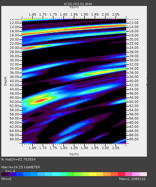
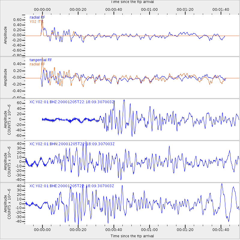
Y02 Y02 - Earthquake Result Viewer

Earthquake location: Fox Islands, Aleutian Islands
Earthquake latitude/longitude: 52.6/-167.8
Earthquake time(UTC): 2000/12/05 (340) 22:11:34 GMT
Earthquake Depth: 33 km
Earthquake Magnitude: 5.6 MB, 5.6 MS, 5.9 MW, 5.4 ML
Earthquake Catalog/Contributor: WHDF/NEIC
Network: XC Yellowstone Intermountain Seismic Array
Station: Y02 Y02
Lat/Lon: 44.07 N/112.64 W
Elevation: 1532 m
Distance: 36.9 deg
Az: 80.673 deg
Baz: 303.334 deg
Ray Param: 0.07638918
Estimated Moho Depth: 24.25 km
Estimated Crust Vp/Vs: 1.60
Assumed Crust Vp: 6.577 km/s
Estimated Crust Vs: 4.111 km/s
Estimated Crust Poisson's Ratio: 0.18
Radial Match: 82.783554 %
Radial Bump: 400
Transverse Match: 73.69026 %
Transverse Bump: 400
SOD ConfigId: 16820
Insert Time: 2010-02-26 15:03:22.811 +0000
GWidth: 2.5
Max Bumps: 400
Tol: 0.001

Signal To Noise

ChannelStoNSTALTA
XC:Y02:01:BHN:20001205T22:18:09.307003Z1.2392217.548503E-66.0913294E-6
XC:Y02:01:BHE:20001205T22:18:09.307003Z1.86218057.0206115E-63.7701025E-6
XC:Y02:01:BHZ:20001205T22:18:09.307003Z1.72073577.1379877E-64.1482185E-6
Arrivals
Ps2.4 SECOND
PpPs8.8 SECOND
PsPs/PpSs11 SECOND