Y02 Y02 - Earthquake Result Viewer
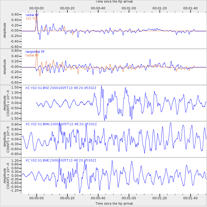
Earthquake location: Northern Mid-Atlantic Ridge
Earthquake latitude/longitude: 31.7/-41.0
Earthquake time(UTC): 2000/10/05 (279) 13:39:11 GMT
Earthquake Depth: 10 km
Earthquake Magnitude: 5.4 MB, 6.1 MS, 6.0 MW, 5.9 MW
Earthquake Catalog/Contributor: WHDF/NEIC
Network: XC Yellowstone Intermountain Seismic Array
Station: Y02 Y02
Lat/Lon: 44.07 N/112.64 W
Elevation: 1532 m
Distance: 56.2 deg
Az: 304.601 deg
Baz: 76.675 deg
Ray Param: 0.06427717
Estimated Moho Depth: 38.25 km
Estimated Crust Vp/Vs: 2.00
Assumed Crust Vp: 6.577 km/s
Estimated Crust Vs: 3.297 km/s
Estimated Crust Poisson's Ratio: 0.33
Radial Match: 80.94207 %
Radial Bump: 400
Transverse Match: 56.28451 %
Transverse Bump: 400
SOD ConfigId: 3744
Insert Time: 2010-02-26 15:03:24.732 +0000
GWidth: 2.5
Max Bumps: 400
Tol: 0.001

Signal To Noise

ChannelStoNSTALTA
XC:Y02:01:BHN:20001005T13:48:20.95302Z1.41790693.1241132E-72.2033274E-7
XC:Y02:01:BHE:20001005T13:48:20.95302Z1.3340782.7435212E-72.0564926E-7
XC:Y02:01:BHZ:20001005T13:48:20.95302Z0.65632541.4878304E-72.2669099E-7
Arrivals
Ps6.1 SECOND
PpPs17 SECOND
PsPs/PpSs23 SECOND