Y02 Y02 - Earthquake Result Viewer
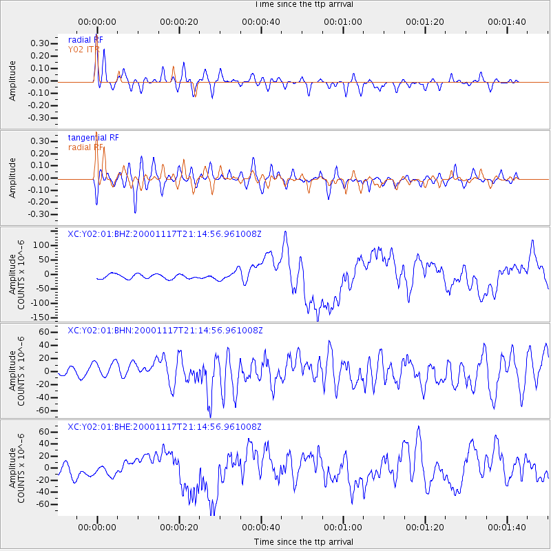
Earthquake location: New Britain Region, P.N.G.
Earthquake latitude/longitude: -5.5/151.8
Earthquake time(UTC): 2000/11/17 (322) 21:01:56 GMT
Earthquake Depth: 33 km
Earthquake Magnitude: 6.2 MB, 8.0 MS, 7.6 MW, 6.9 ME
Earthquake Catalog/Contributor: WHDF/NEIC
Network: XC Yellowstone Intermountain Seismic Array
Station: Y02 Y02
Lat/Lon: 44.07 N/112.64 W
Elevation: 1532 m
Distance: 97.8 deg
Az: 46.391 deg
Baz: 269.916 deg
Ray Param: 0.04008693
Estimated Moho Depth: 16.5 km
Estimated Crust Vp/Vs: 1.70
Assumed Crust Vp: 6.577 km/s
Estimated Crust Vs: 3.863 km/s
Estimated Crust Poisson's Ratio: 0.24
Radial Match: 80.42699 %
Radial Bump: 400
Transverse Match: 69.719826 %
Transverse Bump: 400
SOD ConfigId: 16820
Insert Time: 2010-02-26 15:03:26.058 +0000
GWidth: 2.5
Max Bumps: 400
Tol: 0.001

Signal To Noise

ChannelStoNSTALTA
XC:Y02:01:BHN:20001117T21:14:56.961008Z2.0191121.6975731E-58.407523E-6
XC:Y02:01:BHE:20001117T21:14:56.961008Z0.94995341.0771339E-51.1338808E-5
XC:Y02:01:BHZ:20001117T21:14:56.961008Z2.14832331.673342E-57.789061E-6
Arrivals
Ps1.8 SECOND
PpPs6.6 SECOND
PsPs/PpSs8.4 SECOND