
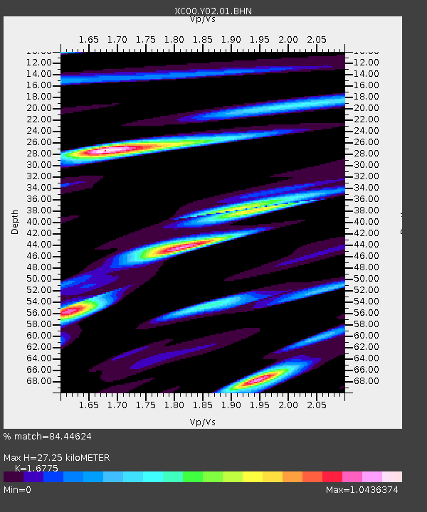
Y02 Y02 - Earthquake Result Viewer
| ||||||||||||||||||
| ||||||||||||||||||
| ||||||||||||||||||
|
Signal To Noise
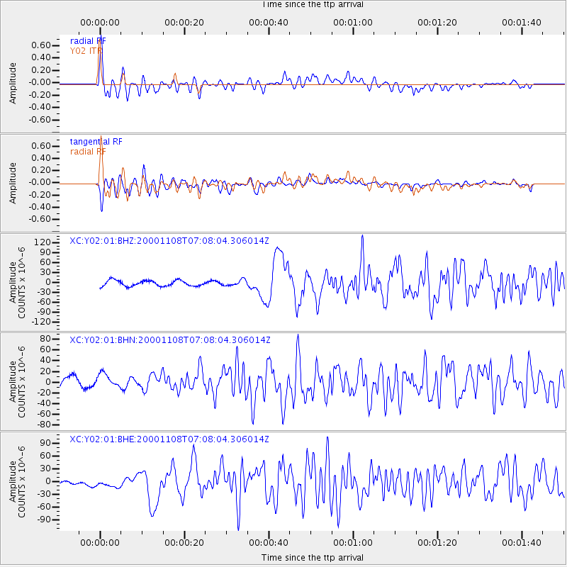
| Channel | StoN | STA | LTA |
| XC:Y02:01:BHN:20001108T07:08:04.306014Z | 1.0023798 | 2.1354328E-5 | 2.130363E-5 |
| XC:Y02:01:BHE:20001108T07:08:04.306014Z | 1.2578951 | 1.377944E-5 | 1.09543635E-5 |
| XC:Y02:01:BHZ:20001108T07:08:04.306014Z | 1.0182438 | 8.834408E-6 | 8.676122E-6 |
| Arrivals | |
| Ps | 3.0 SECOND |
| PpPs | 10 SECOND |
| PsPs/PpSs | 13 SECOND |

