Y02 Y02 - Earthquake Result Viewer
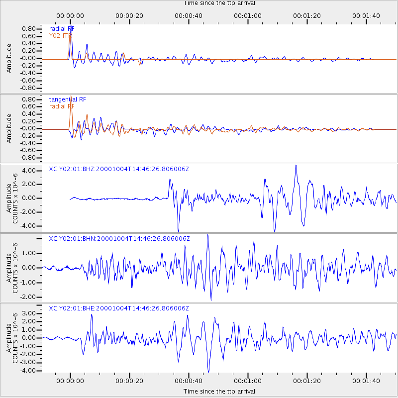
Earthquake location: Windward Islands
Earthquake latitude/longitude: 11.1/-62.6
Earthquake time(UTC): 2000/10/04 (278) 14:37:44 GMT
Earthquake Depth: 110 km
Earthquake Magnitude: 5.6 MB, 5.4 MS, 6.1 MW, 5.9 MD
Earthquake Catalog/Contributor: WHDF/NEIC
Network: XC Yellowstone Intermountain Seismic Array
Station: Y02 Y02
Lat/Lon: 44.07 N/112.64 W
Elevation: 1532 m
Distance: 54.1 deg
Az: 316.945 deg
Baz: 111.626 deg
Ray Param: 0.065348625
Estimated Moho Depth: 36.0 km
Estimated Crust Vp/Vs: 2.01
Assumed Crust Vp: 6.577 km/s
Estimated Crust Vs: 3.272 km/s
Estimated Crust Poisson's Ratio: 0.34
Radial Match: 95.32955 %
Radial Bump: 400
Transverse Match: 85.36117 %
Transverse Bump: 400
SOD ConfigId: 16820
Insert Time: 2010-02-26 15:03:28.996 +0000
GWidth: 2.5
Max Bumps: 400
Tol: 0.001

Signal To Noise

ChannelStoNSTALTA
XC:Y02:01:BHN:20001004T14:46:26.806006Z0.55641581.0820818E-71.9447359E-7
XC:Y02:01:BHE:20001004T14:46:26.806006Z3.98959066.3883743E-71.6012605E-7
XC:Y02:01:BHZ:20001004T14:46:26.806006Z14.5958561.1144076E-67.635096E-8
Arrivals
Ps5.8 SECOND
PpPs16 SECOND
PsPs/PpSs21 SECOND